DJI Flight Hub 2
Product prices displayed on the website do not include VAT. VAT will be applied at the rate prescribed by the State at the applicable time.
Shipping fees (if any) are calculated based on the destination, weight and order value, and will be displayed at checkout before the customer confirms the order.
DJI FlightHub 2
Smart Cloud-Based Drone Operations
All-in-one centralized drone management platform
DJI FlightHub 2 is a cloud-based drone operation and management platform that enables remote control, intelligent flight scheduling, flexible mission planning, and seamless third-party system integration.
Powered by next-generation AI algorithms and a multimodal language model (LLM), the platform transforms workflows in engineering, construction, public safety, emergency response, mapping, and infrastructure inspection — enabling fully automated air-to-ground operations with powerful situational awareness and command capabilities.
1. Real-Time Remote Control
Virtual Cockpit
• Control drones easily using a mouse and keyboard
• Mouse-look view and drag-to-zoom for fast, precise camera control
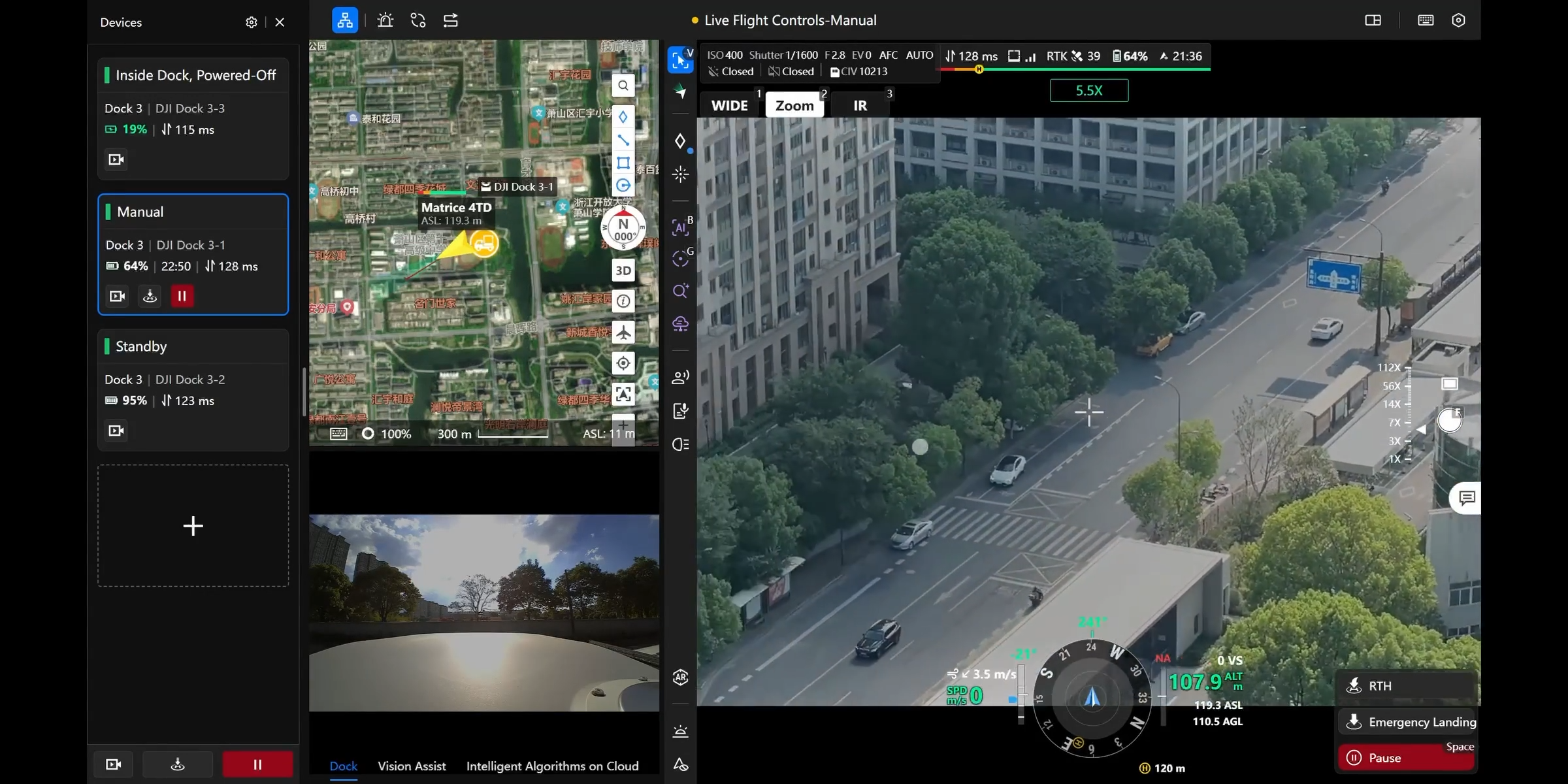
Multi-Drone Control
• Operate multiple drones simultaneously within the same cockpit interface
• One-click mission switching and Return-to-Home for efficient fleet coordination
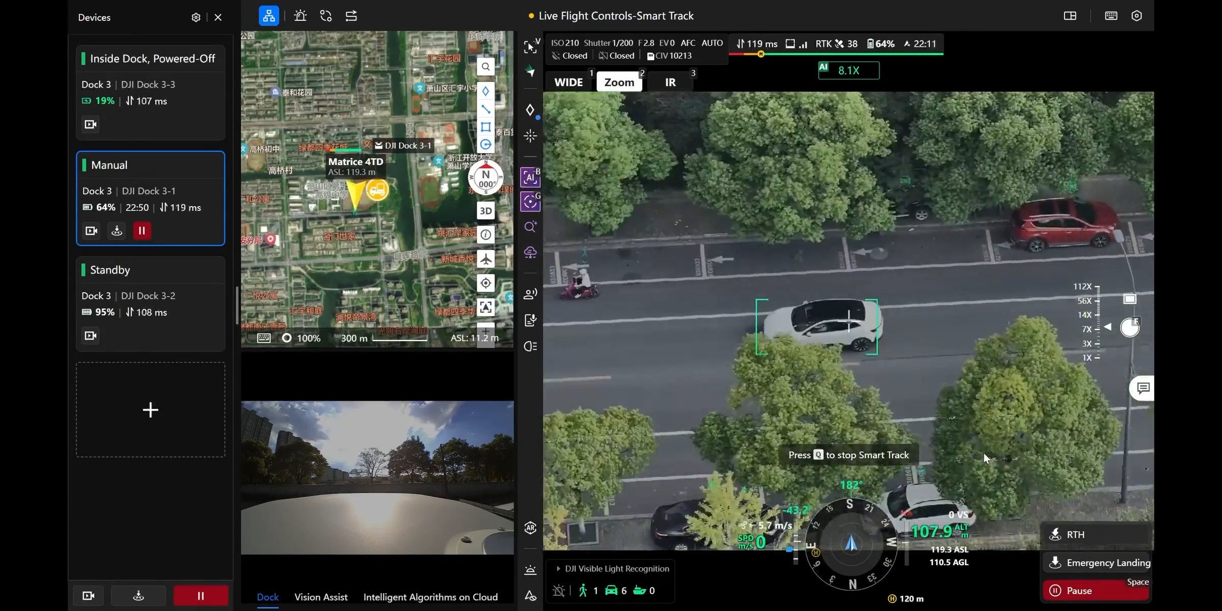
Intelligent Tracking
• Supports detection of vehicles, vessels, people, and more
• Auto-counting, alerting, and continuous tracking for optimized surveillance
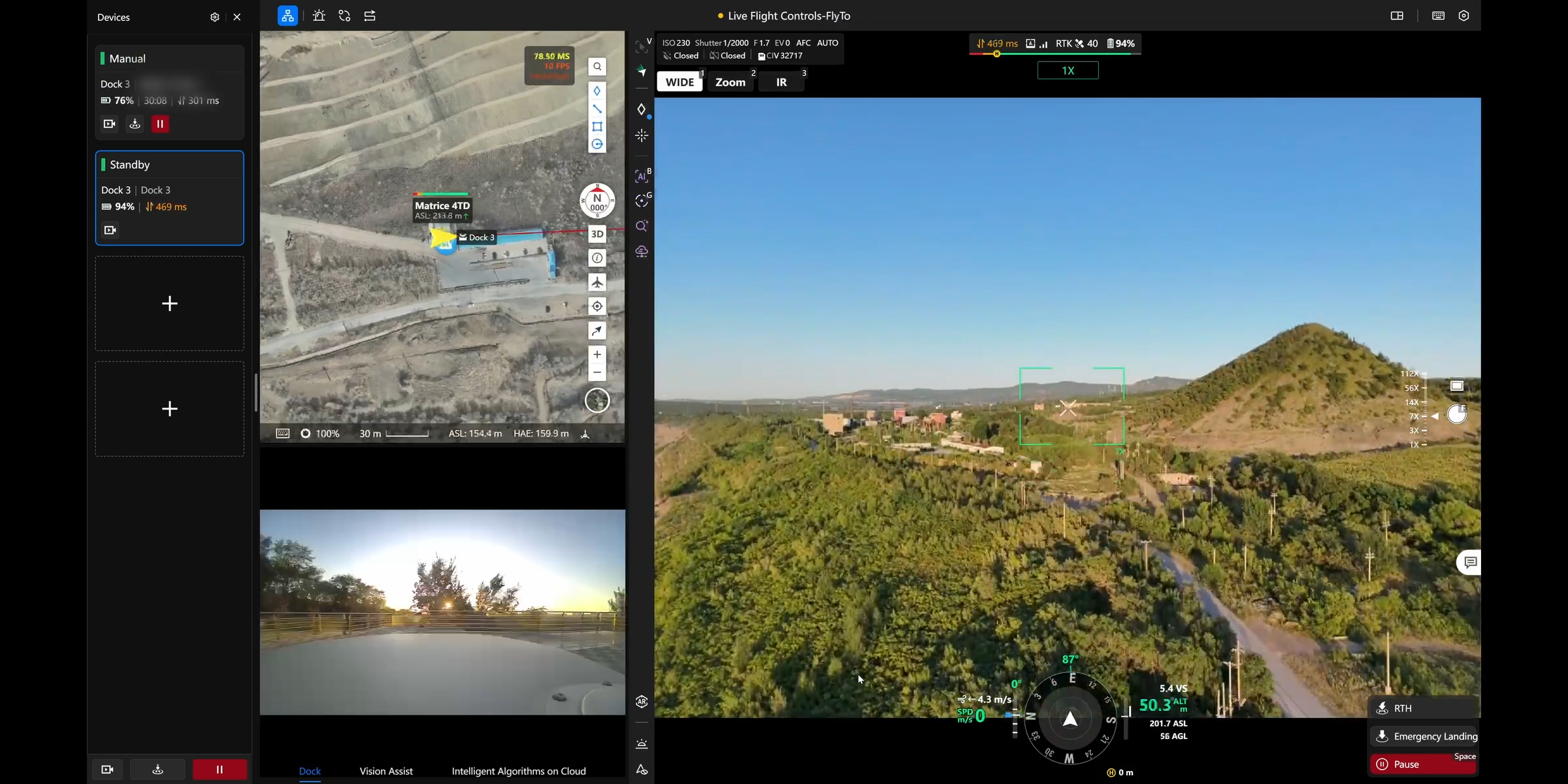
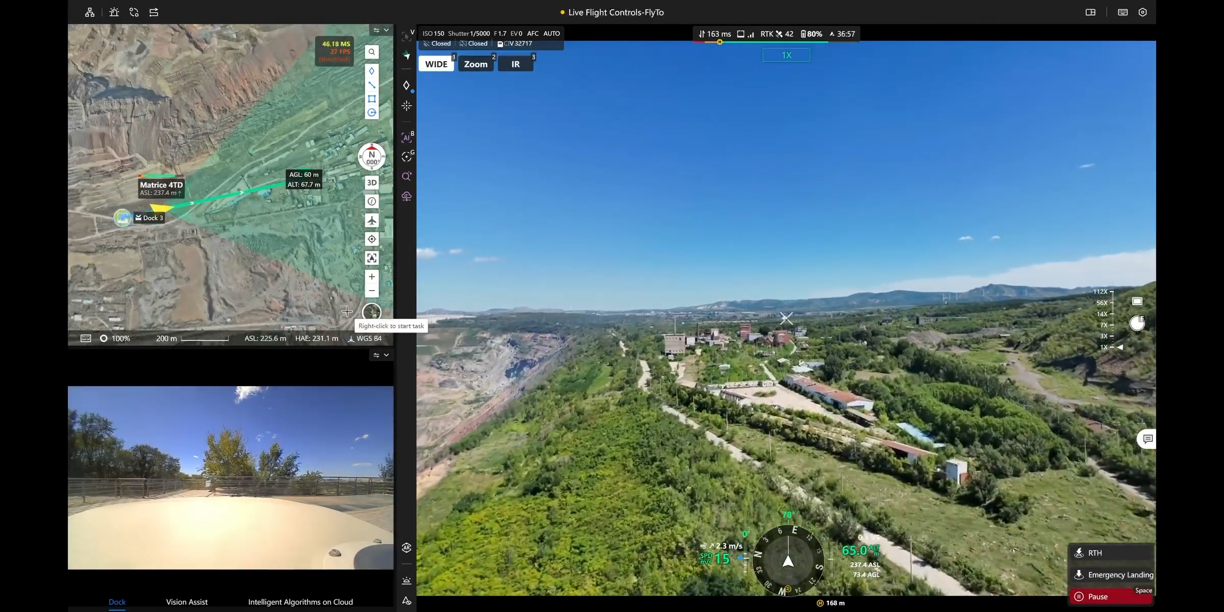
FlyTo Mission
• Select any point on the map → system auto-generates an optimal route
• Drone flies to target safely and quickly, ideal for emergency response
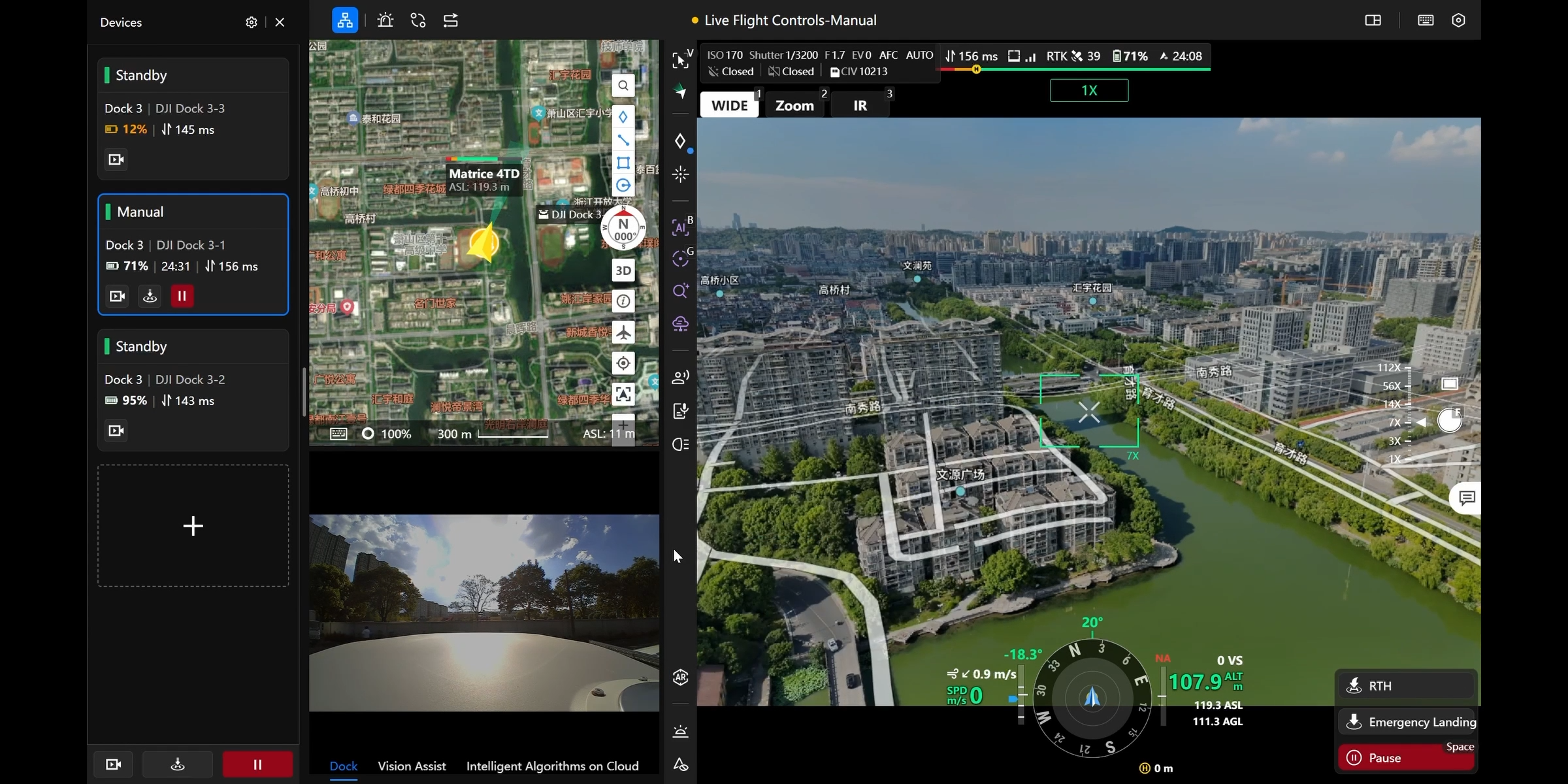
AR Map Overlay
• 3D building and road data overlaid directly onto the live video feed
• Enhances situational awareness in complex environments
2. Ground-to-Cloud Collaboration
Centralized Dashboard
• Displays device status, mission progress, and flight statistics in real time
• Enables fast decision-making with clear and intuitive data visuals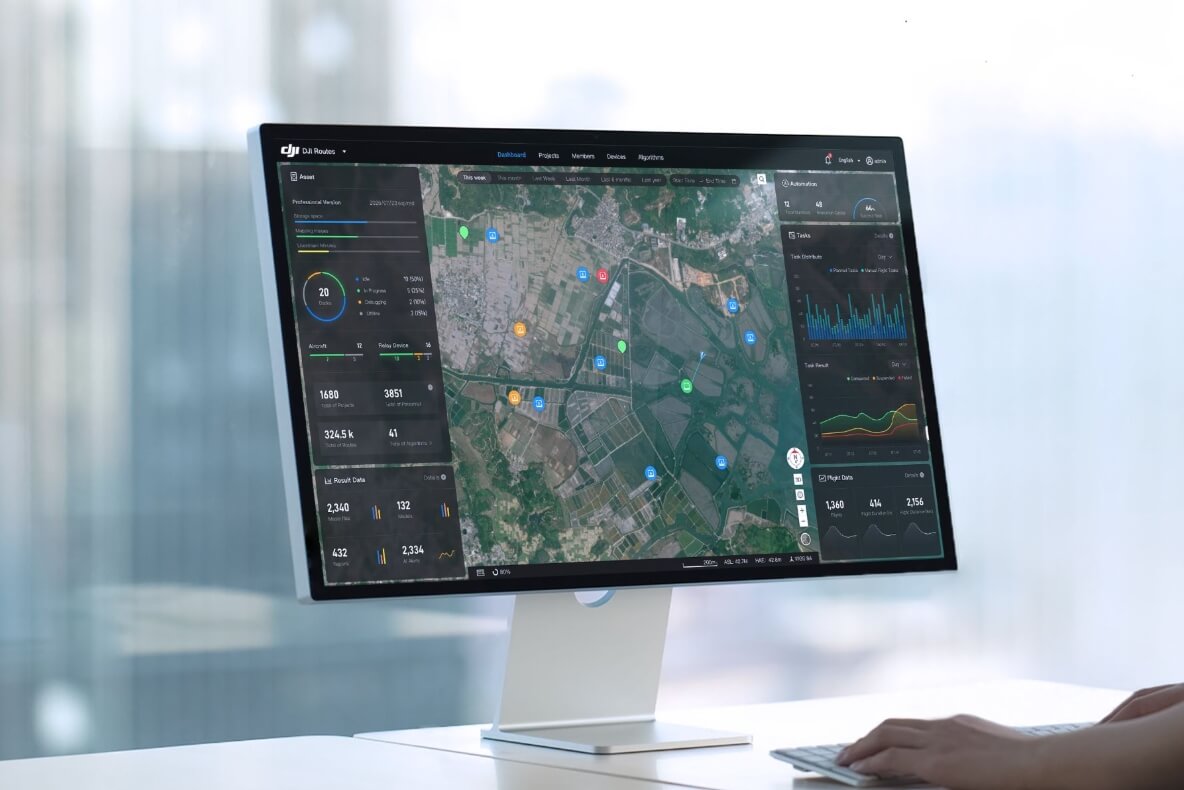
Live Annotations
• Mark objects, draw mission areas, and assign zones directly on the shared interface
• All edits sync instantly across all connected users
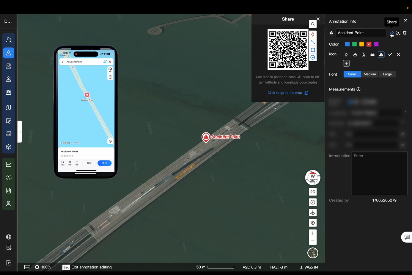
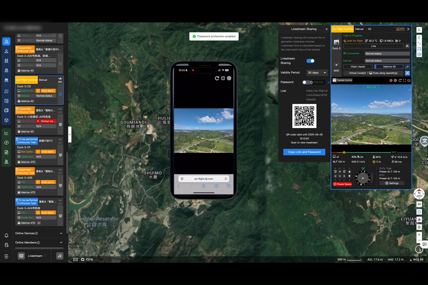
Live Broadcast Sharing
• Generate livestream links instantly, share via QR code for immediate access
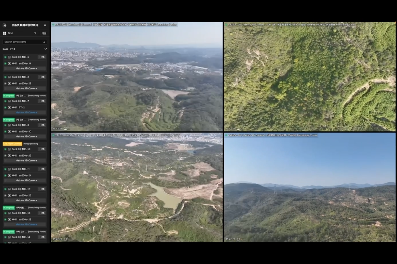
Multi-Channel Streaming
• View multiple drone streams simultaneously
• Flexible layout selection for full situational awareness
3. Comprehensive Mission Planning
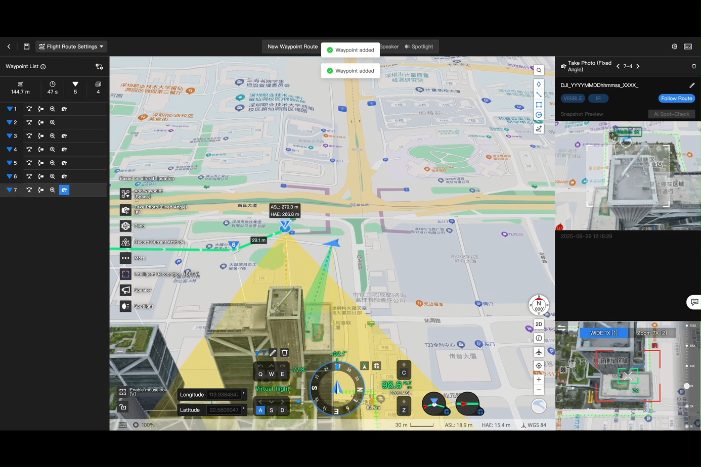
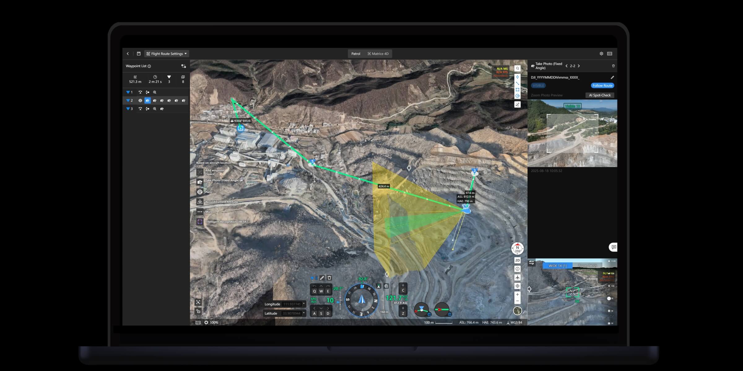
3D Route Editing
• Create waypoint missions directly on 3D models
• Supports object-based inspection points along the route
Patrol Missions
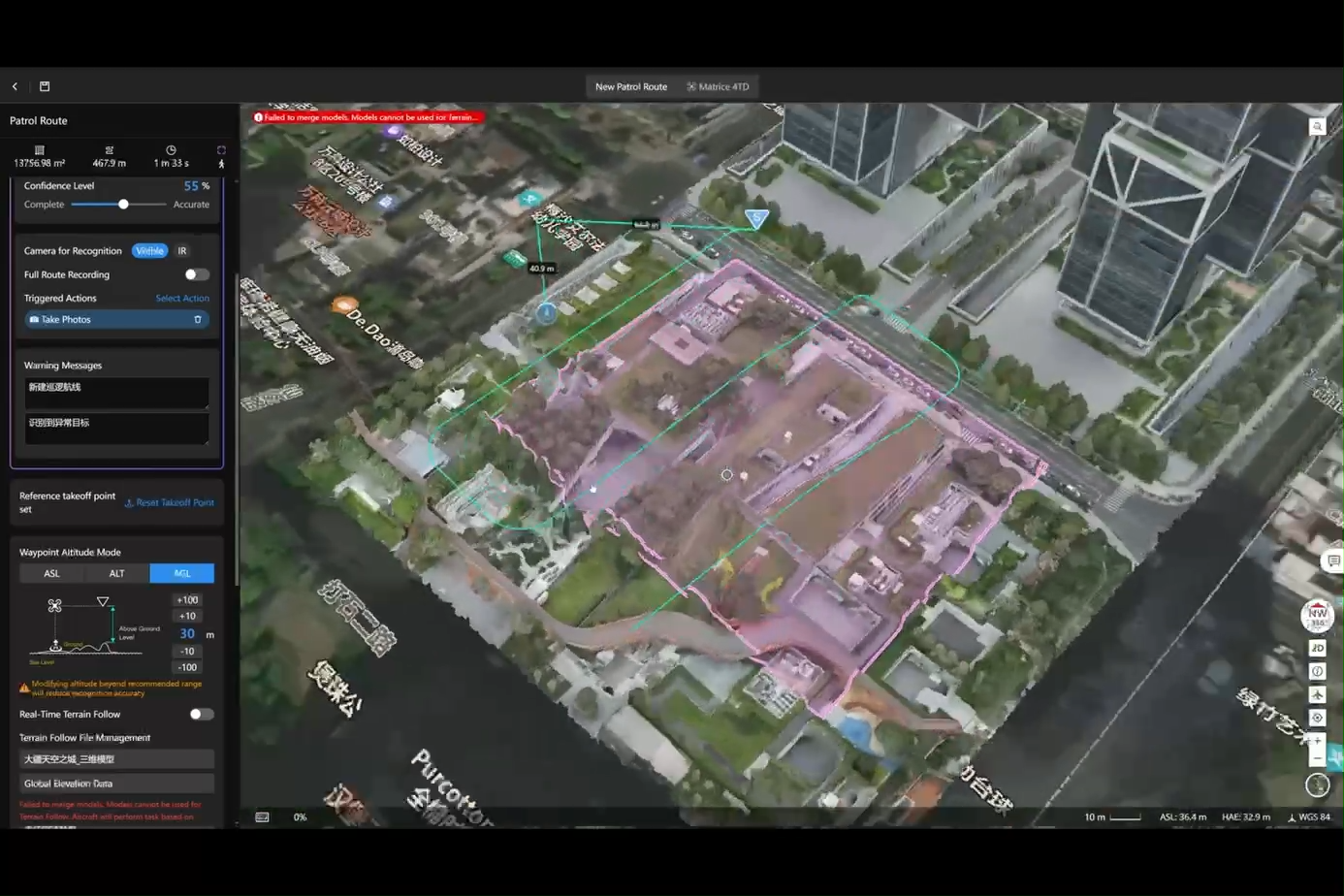
• Auto-generate patrol routes based on regions or target objects
• Drones scan, record, and alert when detecting targets
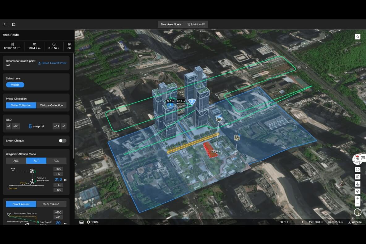
2D/3D Mapping Missions
• Ideal for surveying and large-area mapping
• Adjustable overlap settings, auto no-fly zone avoidance
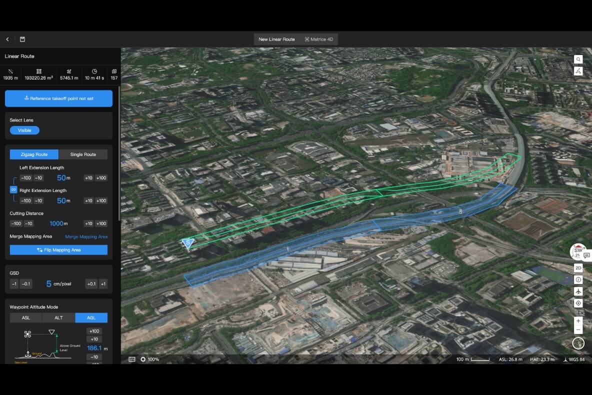
Linear Route Missions (Pipelines, Powerlines, Roads, Rivers...)
• Auto-split long routes into multiple flights
• Perfect for infrastructure inspection
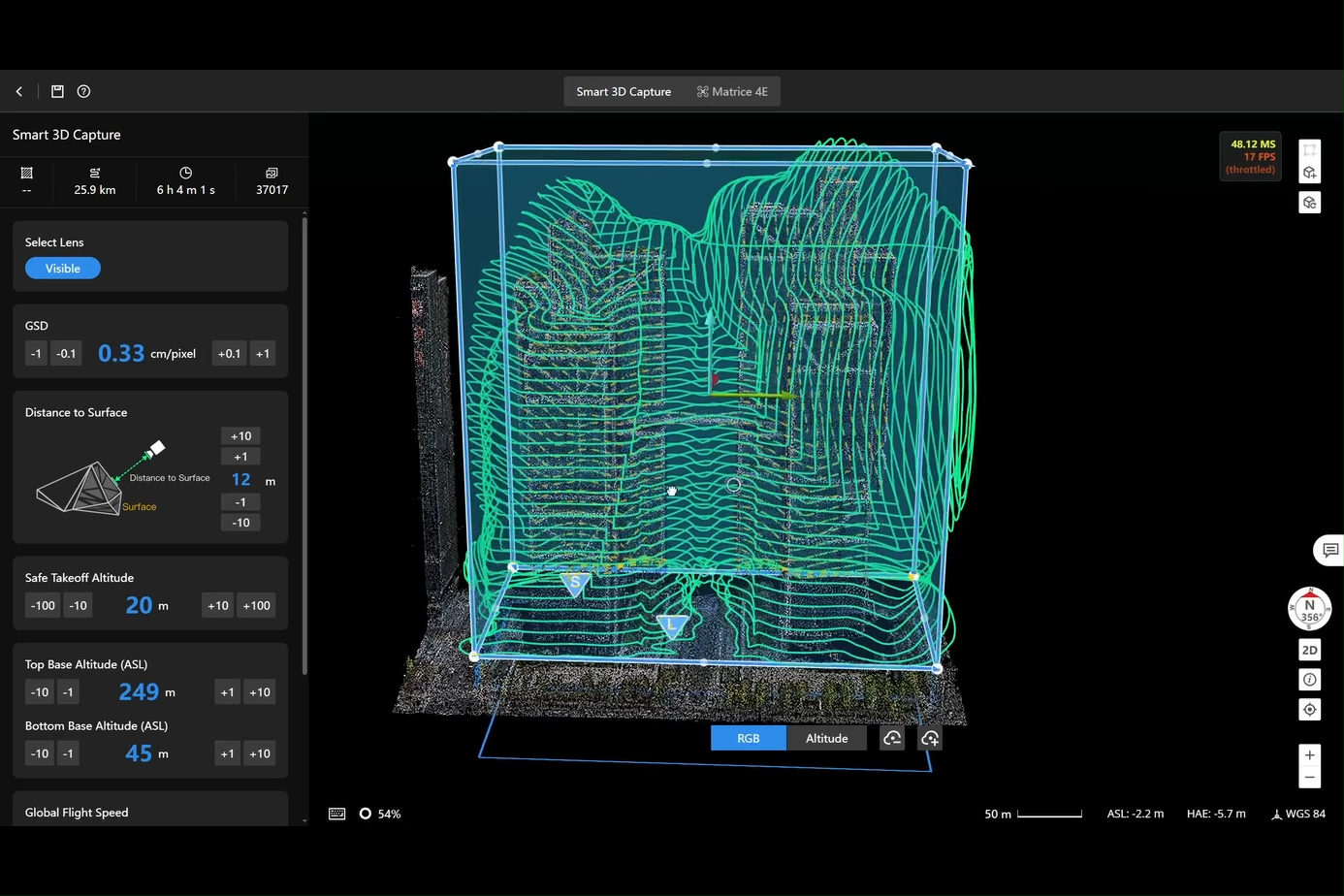
Smart 3D Scanning
• Generates surface-fitted flight paths to capture high-detail 3D datasets
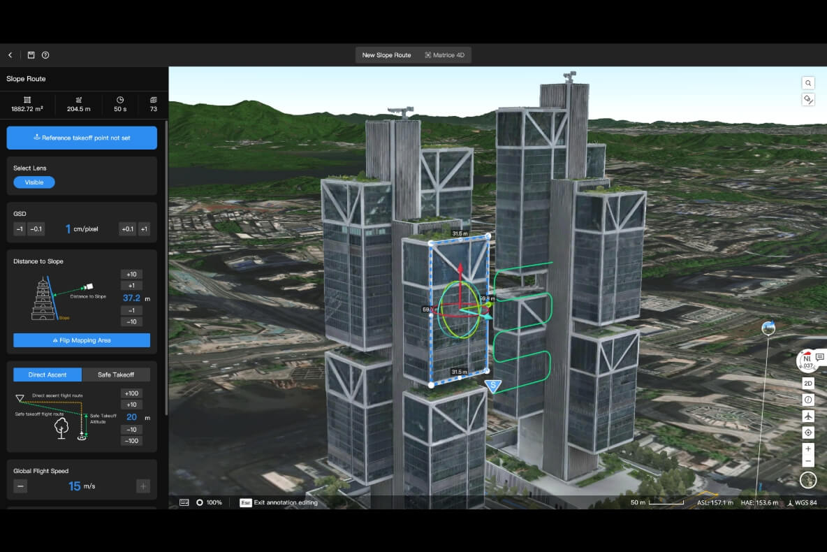
Slope / Single-Side Missions
• For bridges, slopes, retaining walls, cliff faces, and tilted structures
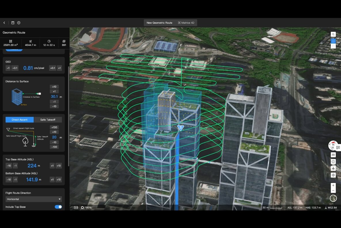
Building Envelope Mission
• Auto-plan routes around buildings in 3D, with visual safety assessment
All mission plans auto-sync to the remote controller — no manual transfer required.
4. Intelligent Algorithms for Precision Inspection
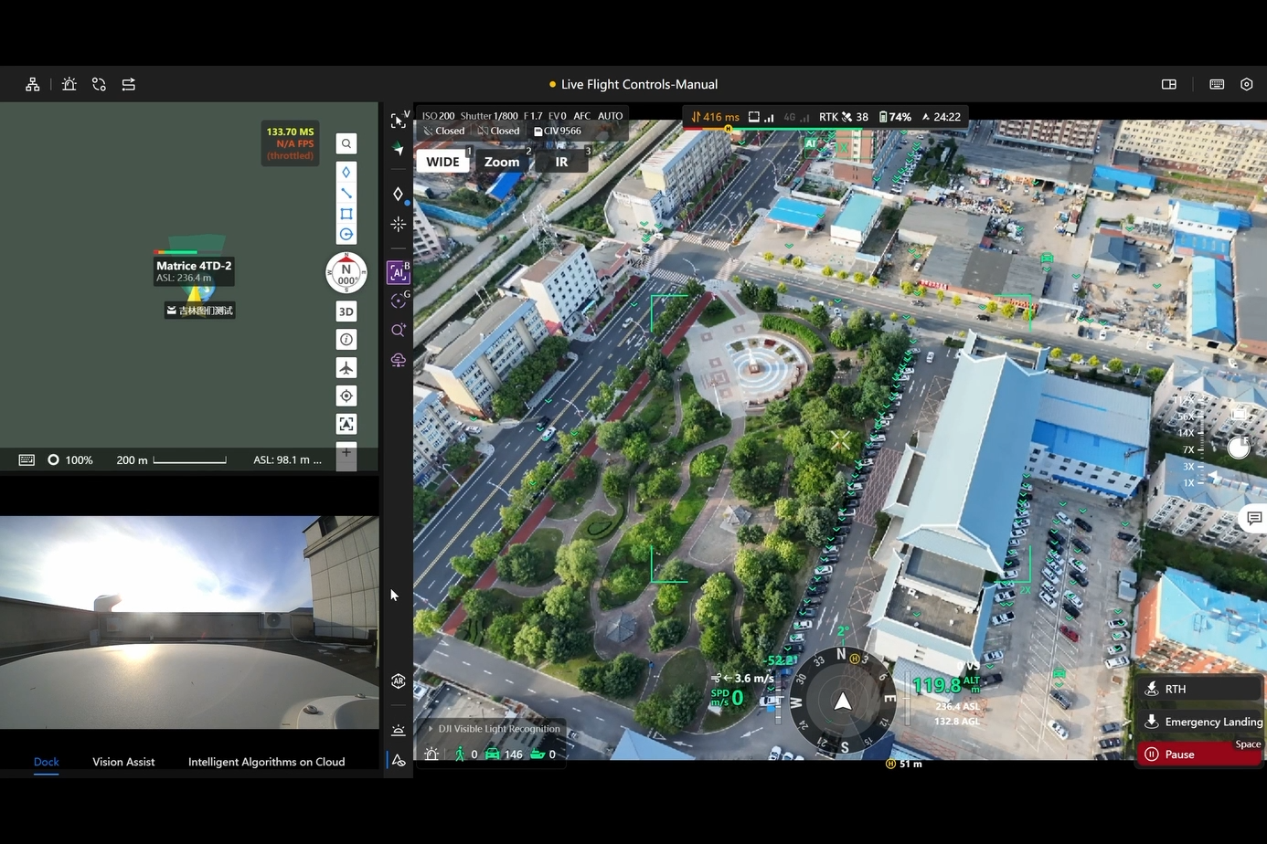
Smart Detection
• AI automatically detects & counts vehicles, vessels, etc.
• Supports integration of third-party AI models
Automated Alerts
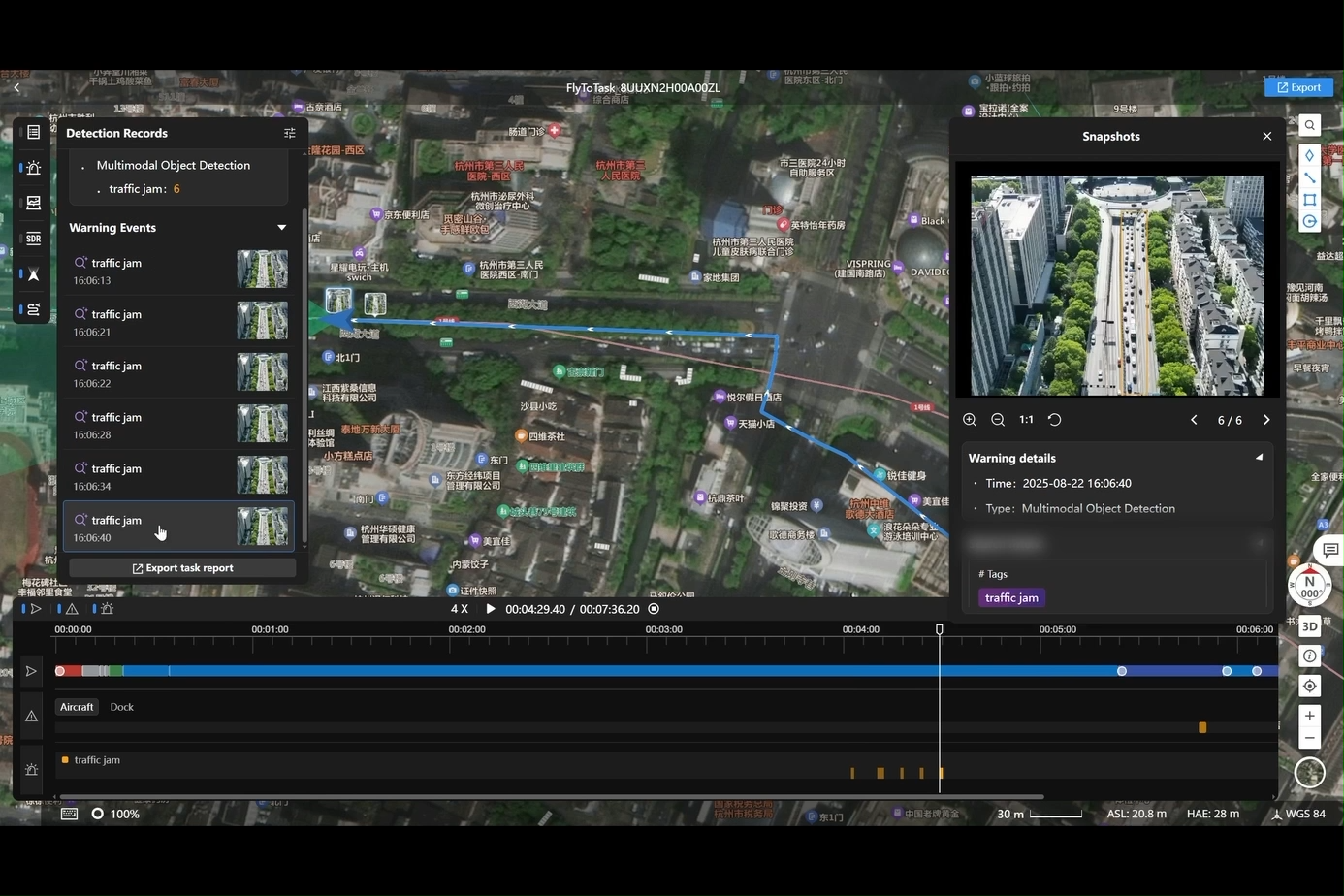
• System auto-creates incident alerts with:
– object type
– coordinates
– timestamp
– captured image
• Auto-generated incident reports for traceability
Smart Patrol
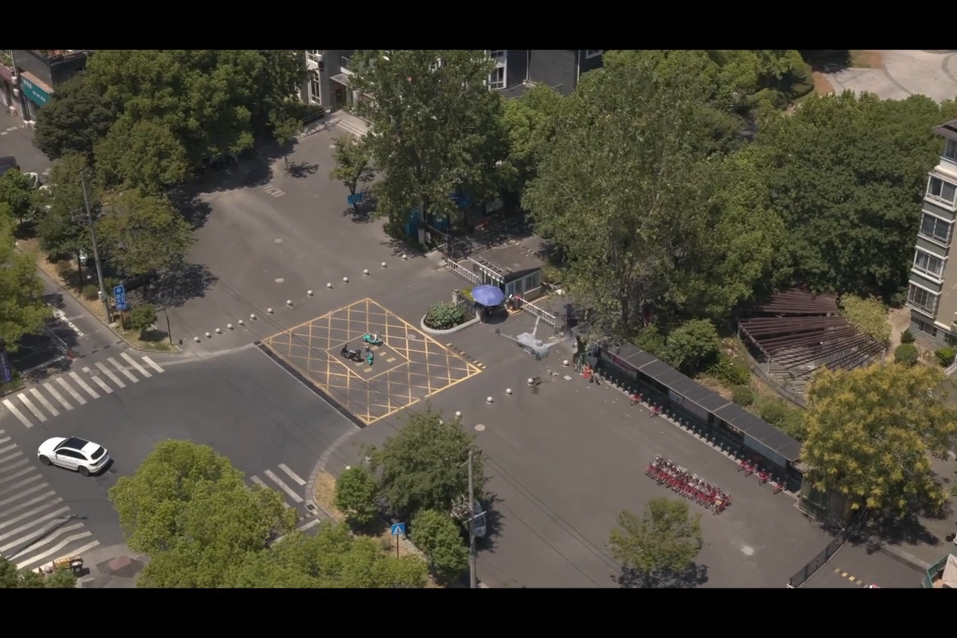
• Combines auto route + AI detection → fully automated patrol workflow
• Auto-alert, auto-record, auto-report
5. Multimodal Language Model (LLM)
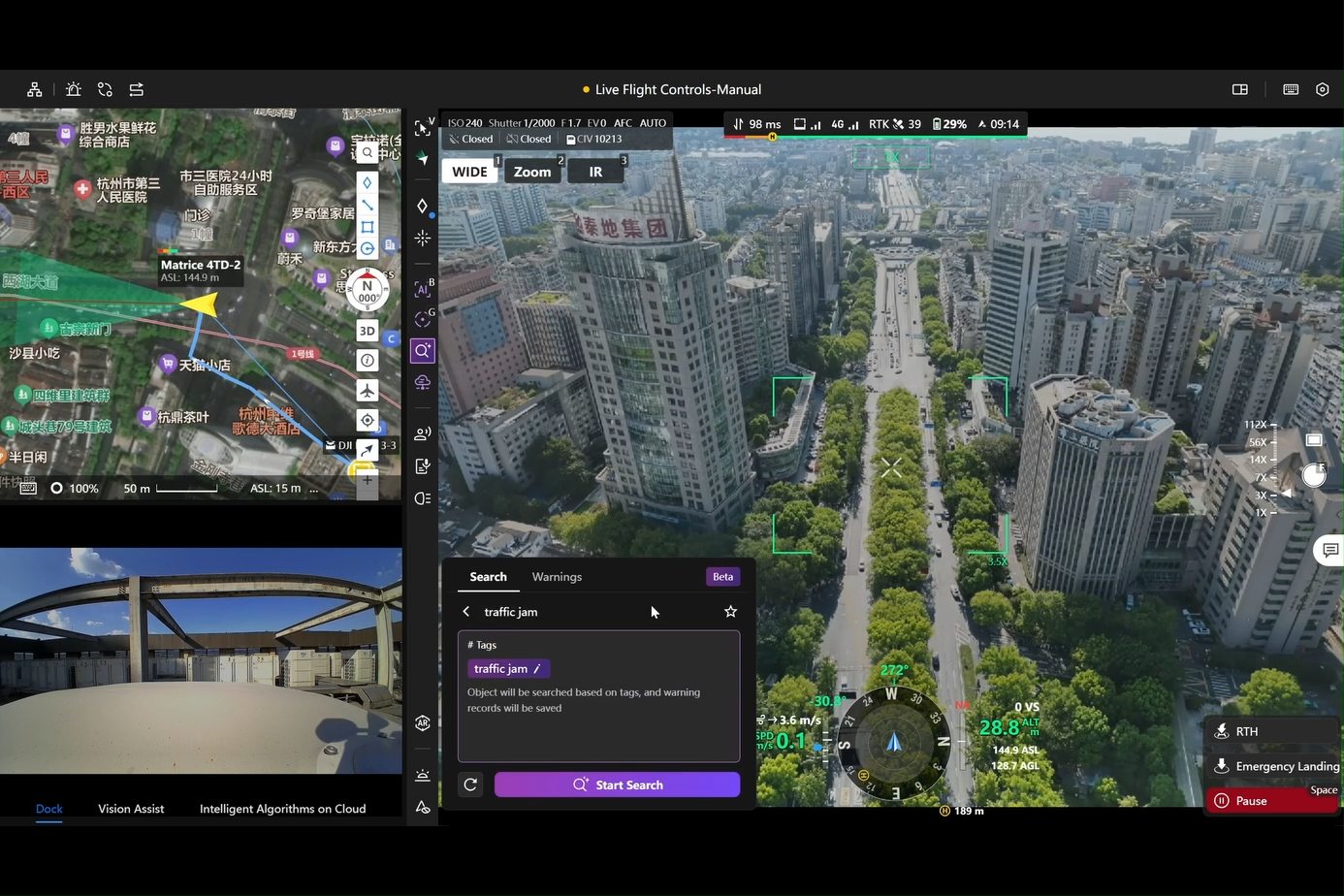
Multimodal Recognition
• Search for targets using text or image prompts
• System understands requests, auto-detects and alerts
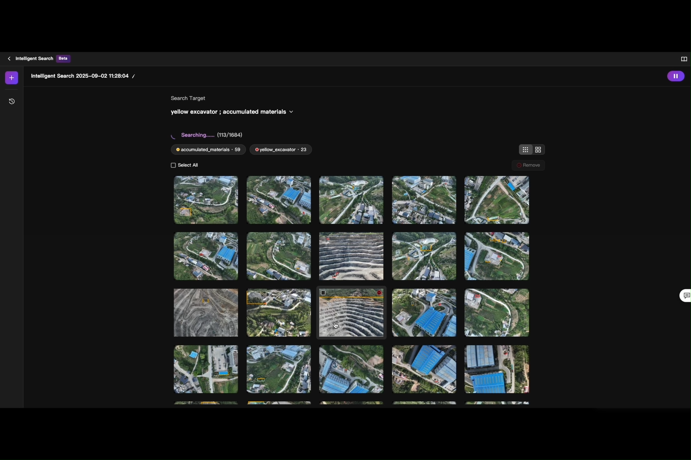
Multimodal Image Search
• Input image or keywords → retrieves related drone media from database
• Extremely useful for rapid reporting and investigation
6. Open Algorithms – Smarter Than Ever
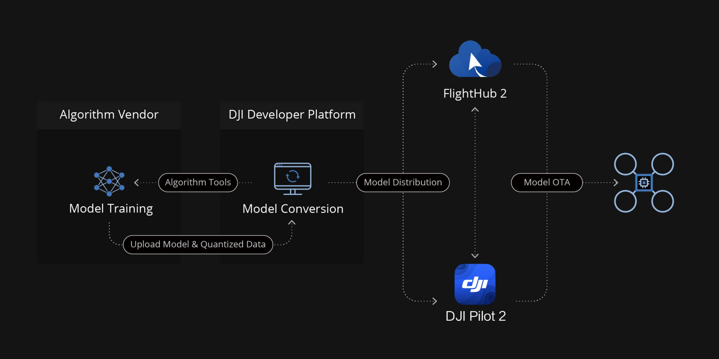
On-Drone AI
• Supports custom third-party algorithms on drone compute modules & Manifold 3
• Virtual Cockpit allows switching between built-in and external algorithms
• Expandable detection, analysis, and recognition capabilities
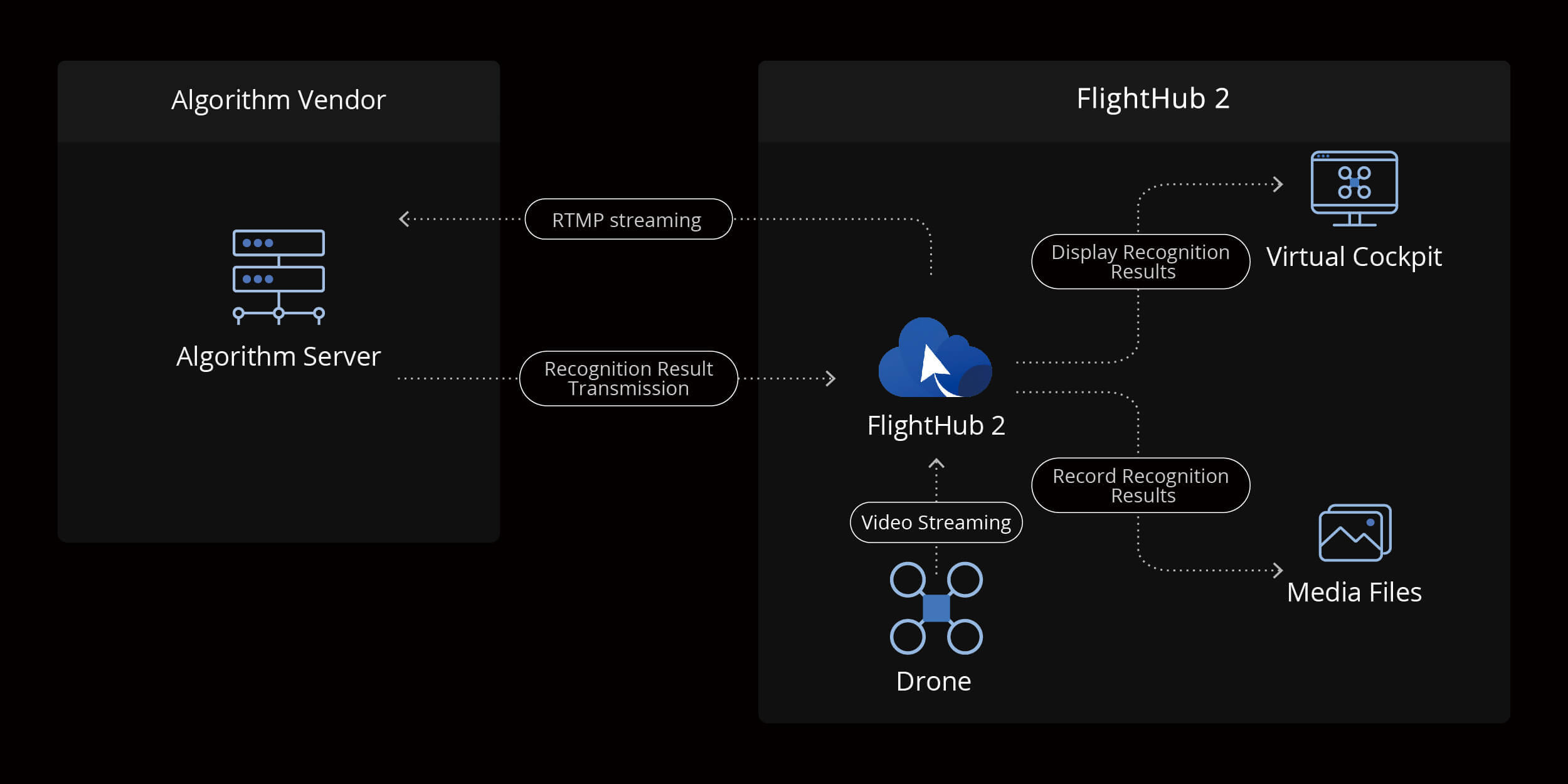
Cloud-Based AI
• Manage, deploy, and activate AI models directly from the cloud
• Virtual Cockpit can call cloud AI models in real time
• Enables high-performance inference without depending on drone hardware
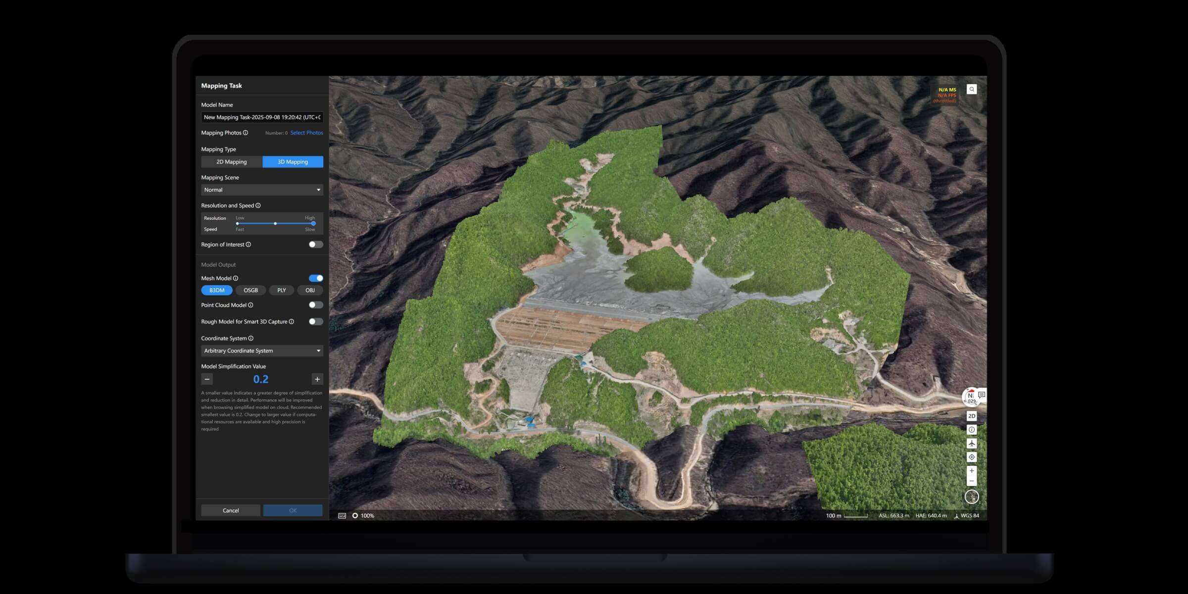
Cloud Modeling
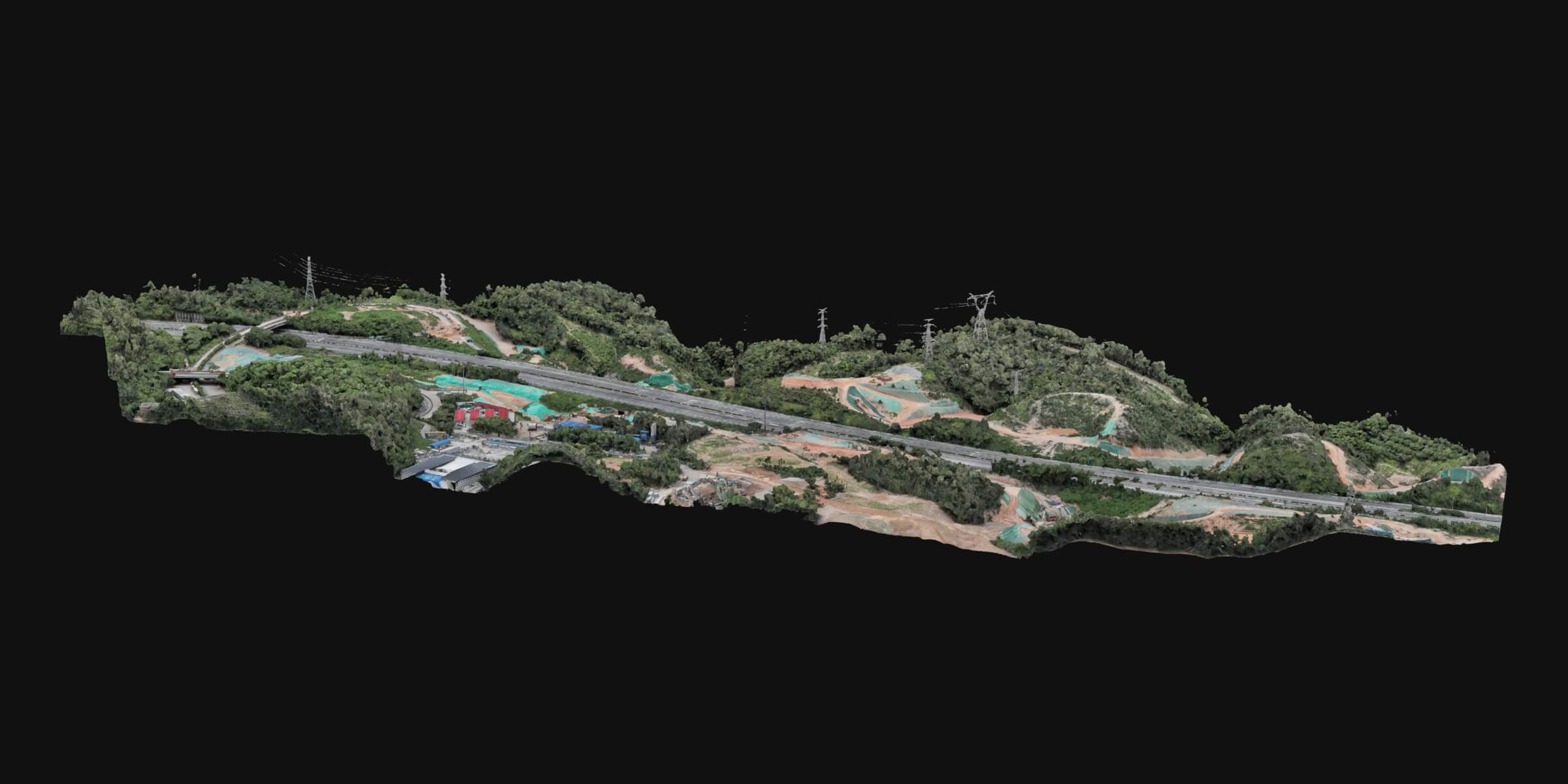
• Auto-generate 2D/3D models and point clouds from flight data
• Supports real-time modeling during flight
• Measurement accuracy: 1:500 mapping standard, export to industry formats
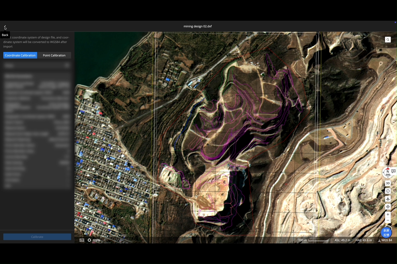
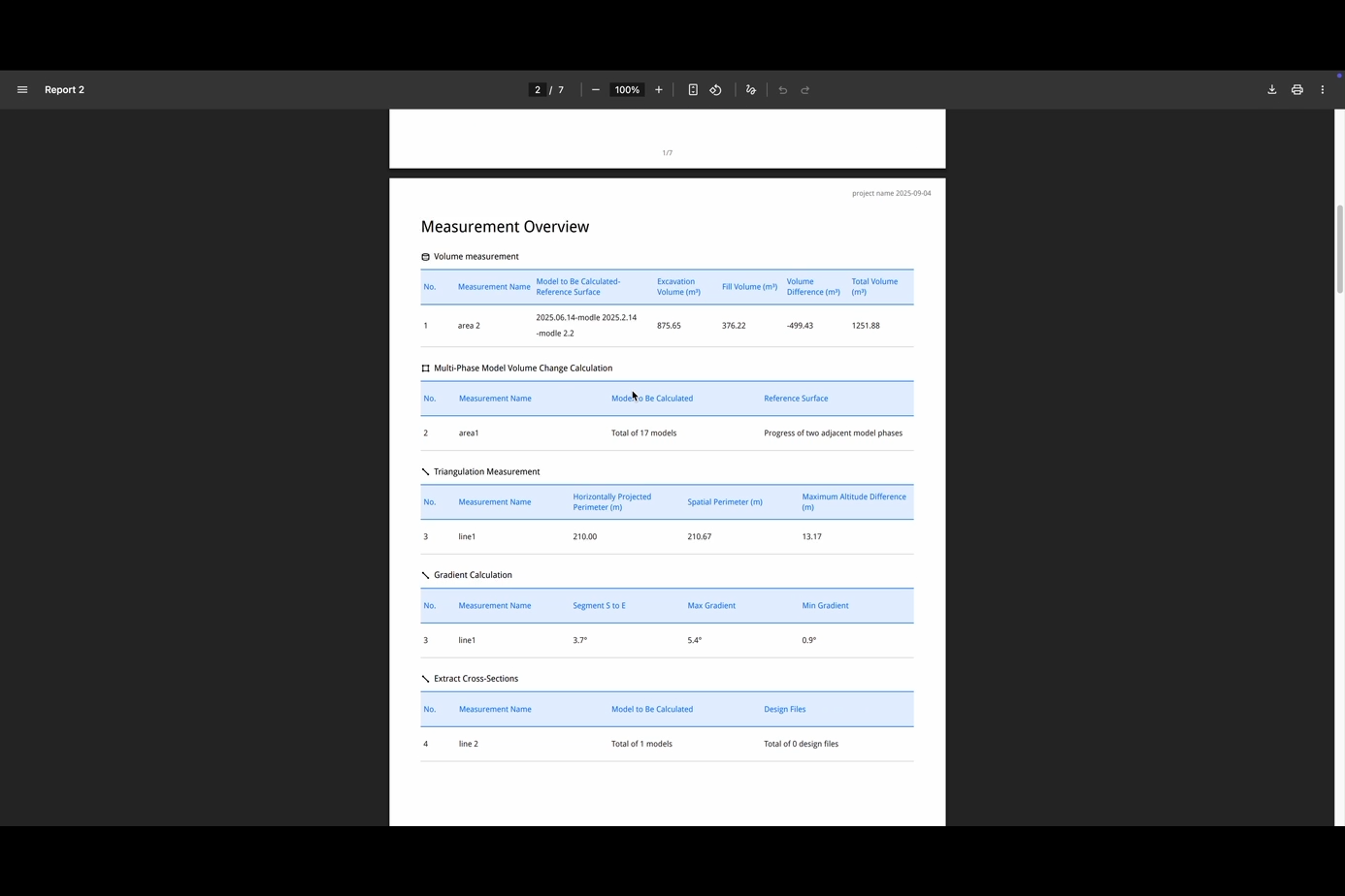
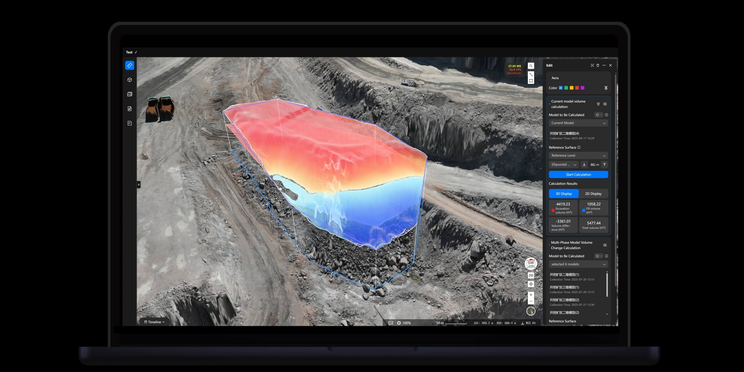
Analyzer Toolset
• Import PDF, DXF design files and align coordinates for comparison
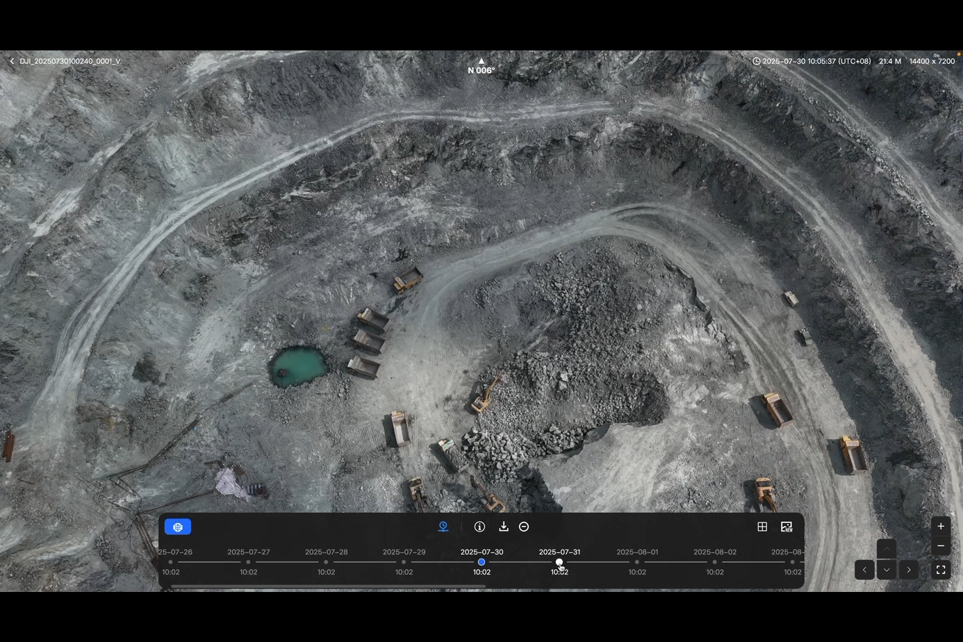
• Timeline-based change analysis
• Built-in measurement tools: distance, elevation, area, volume
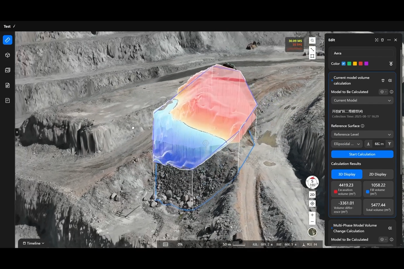
• Auto-generate measurement and progress reports
7. Data Application
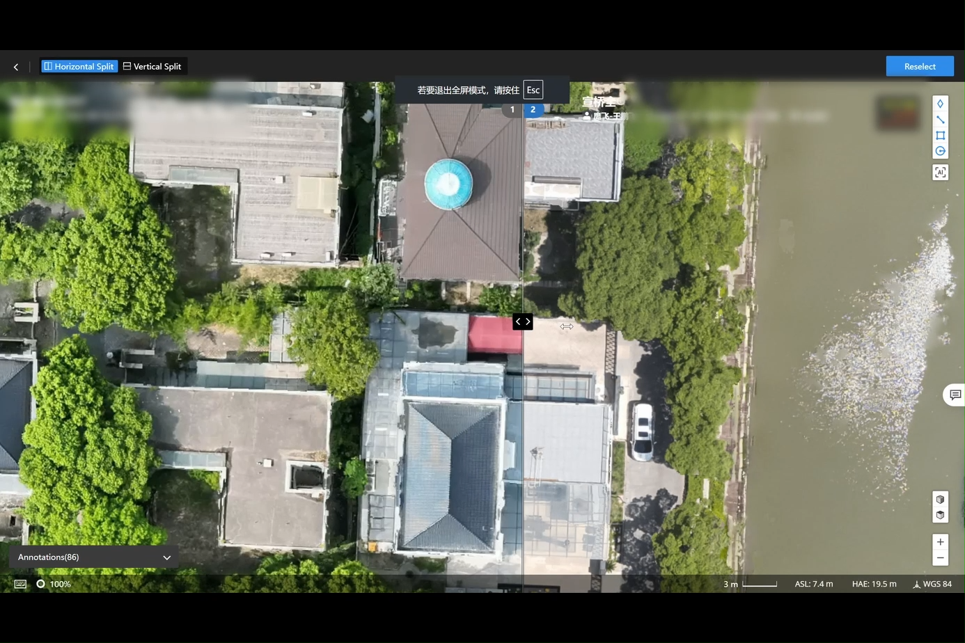
Result Comparison
• Side-by-side comparison of photos, videos, or 2D maps
• Annotations sync directly to the map layer
• Helps teams analyze differences across inspections
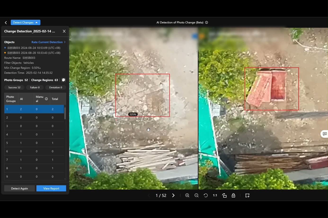
Change Detection
• Auto-detect changes between two top-down images or orthomosaics
• Generates detection reports with change-area statistics
• Ideal for structural monitoring, terrain shifts, infrastructure security
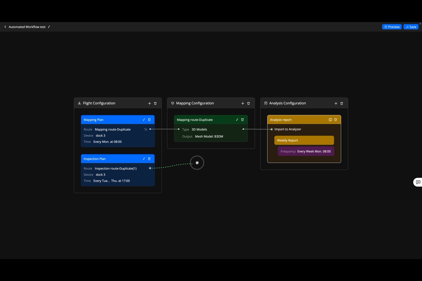
8. Seamless Automated Workflows
Flight Route Planning
• Multiple planning modes for complex terrains and diverse mission needs
Flight Scheduling
• Automated recurring missions by task type
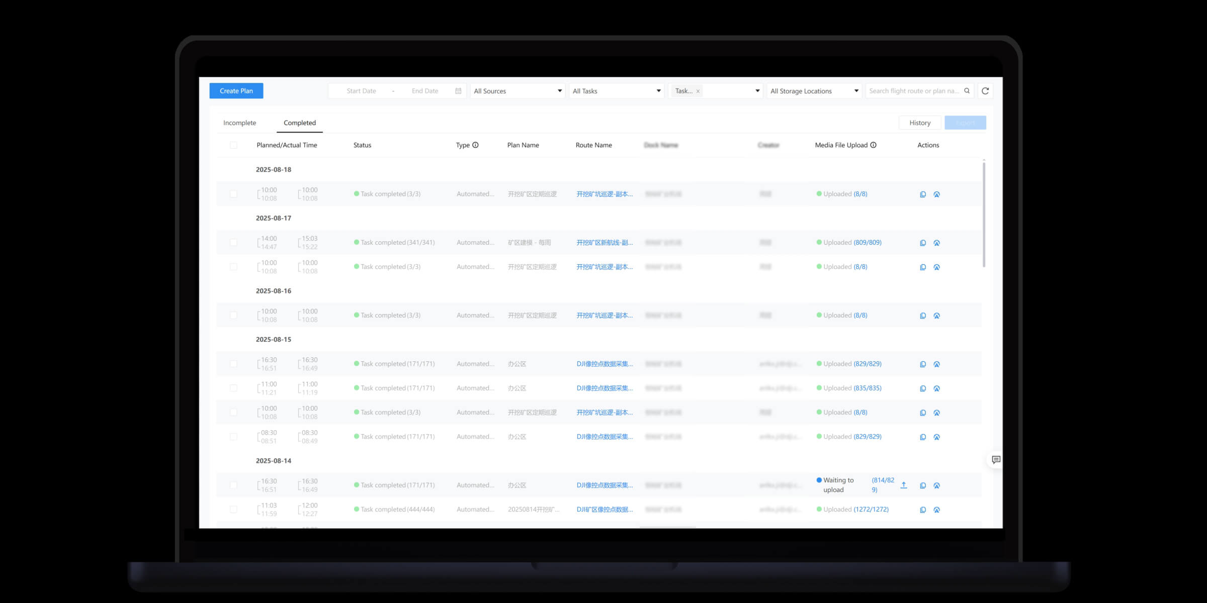
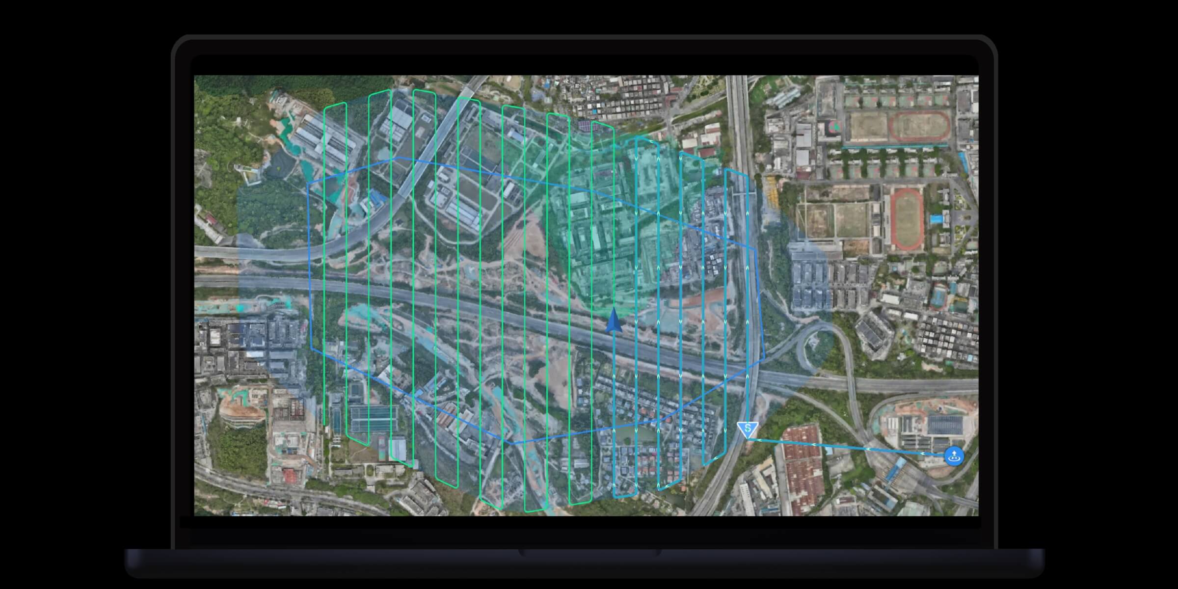
Task Execution
• Drones fly automatically, capturing consistent, high-accuracy data
Cloud Modeling
• Survey results auto-uploaded to cloud for fast 2D/3D modeling
Data Analysis
• Data auto-synced to Analyzer tool for assessment & decision-making
Drag-and-Drop Workflow Builder
• Full pipeline automation: collect → model → analyze → report
• Enables fully scheduled, periodic, unattended operations
9. Operational Safety & Compliance
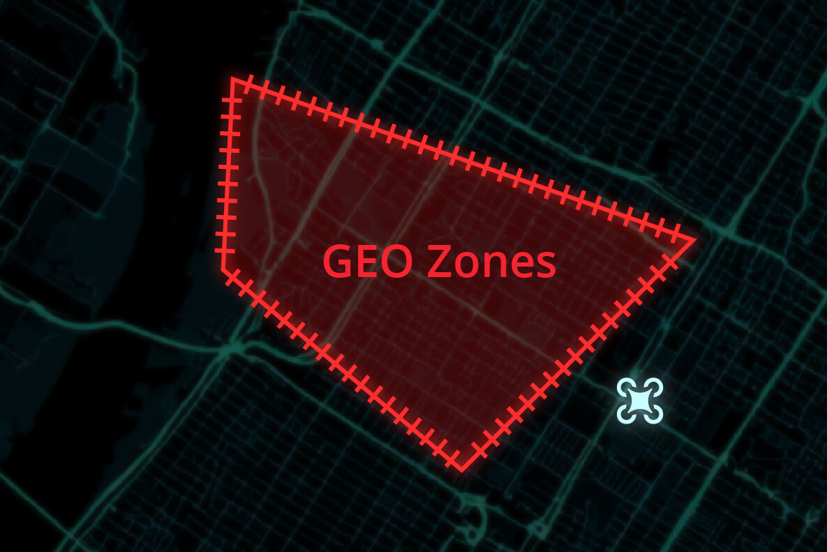
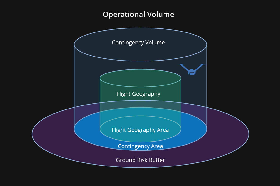
Custom GEO Zone
• Define mission areas, no-fly zones, no-landing zones, and obstacles
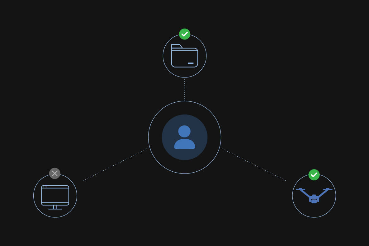
Role-Based Project Permissions
• Custom access control for secure and orderly task management
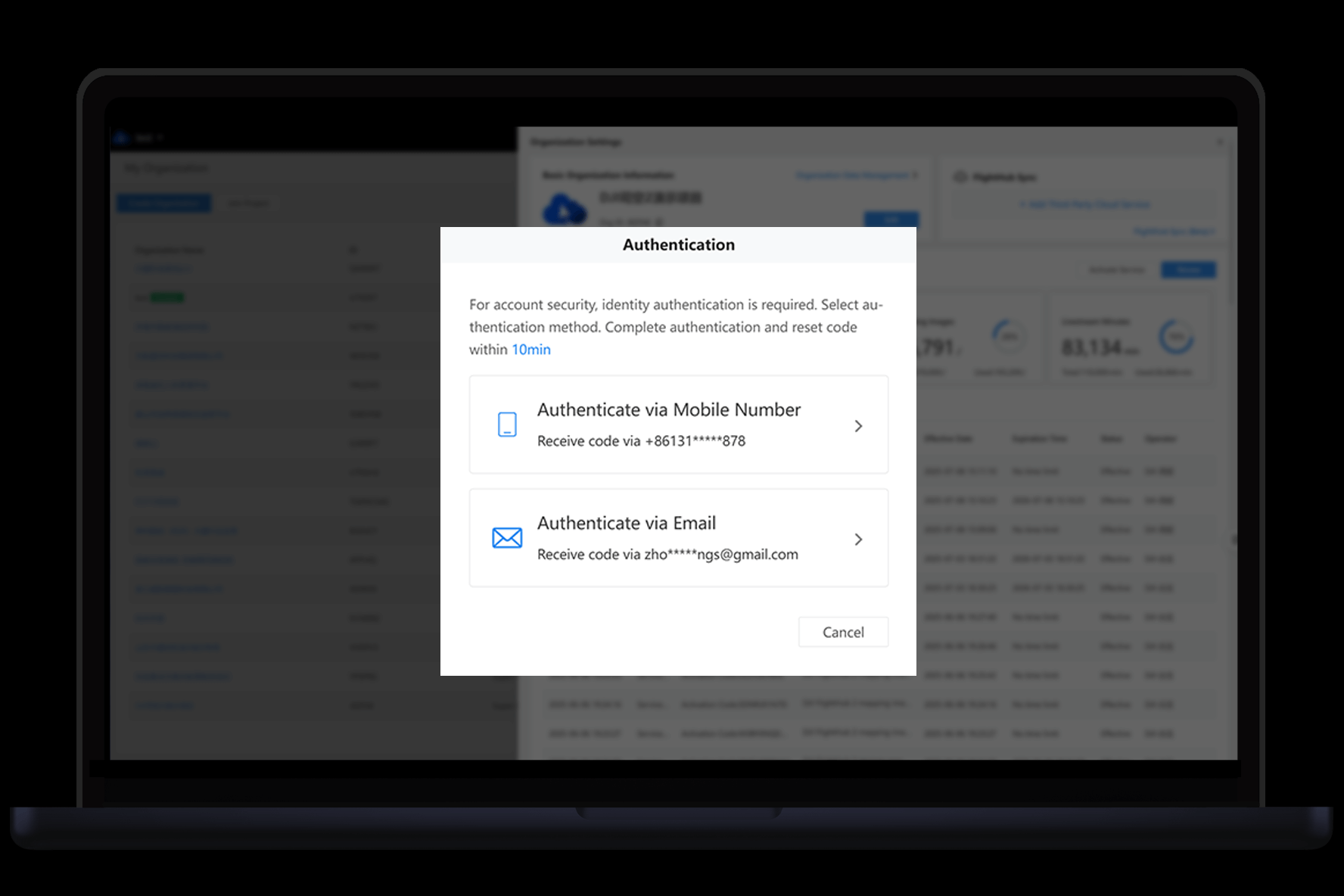
Secure Login Authentication
• Supports SSO & MFA
• Blocks unauthorized access and protects system data
ADS-B
• Receives nearby manned aircraft signals, warns of airspace conflict
• Enhances low-altitude flight safety

Localized Compliance
• Activates geofencing, backup control links, remote ID per regional laws
10. Remote Operations & Maintenance
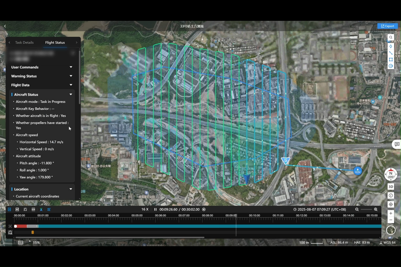
Flight Records
• Logs all manual and remote flights with drone status and operator actions
• One-click export of summary and detailed logs
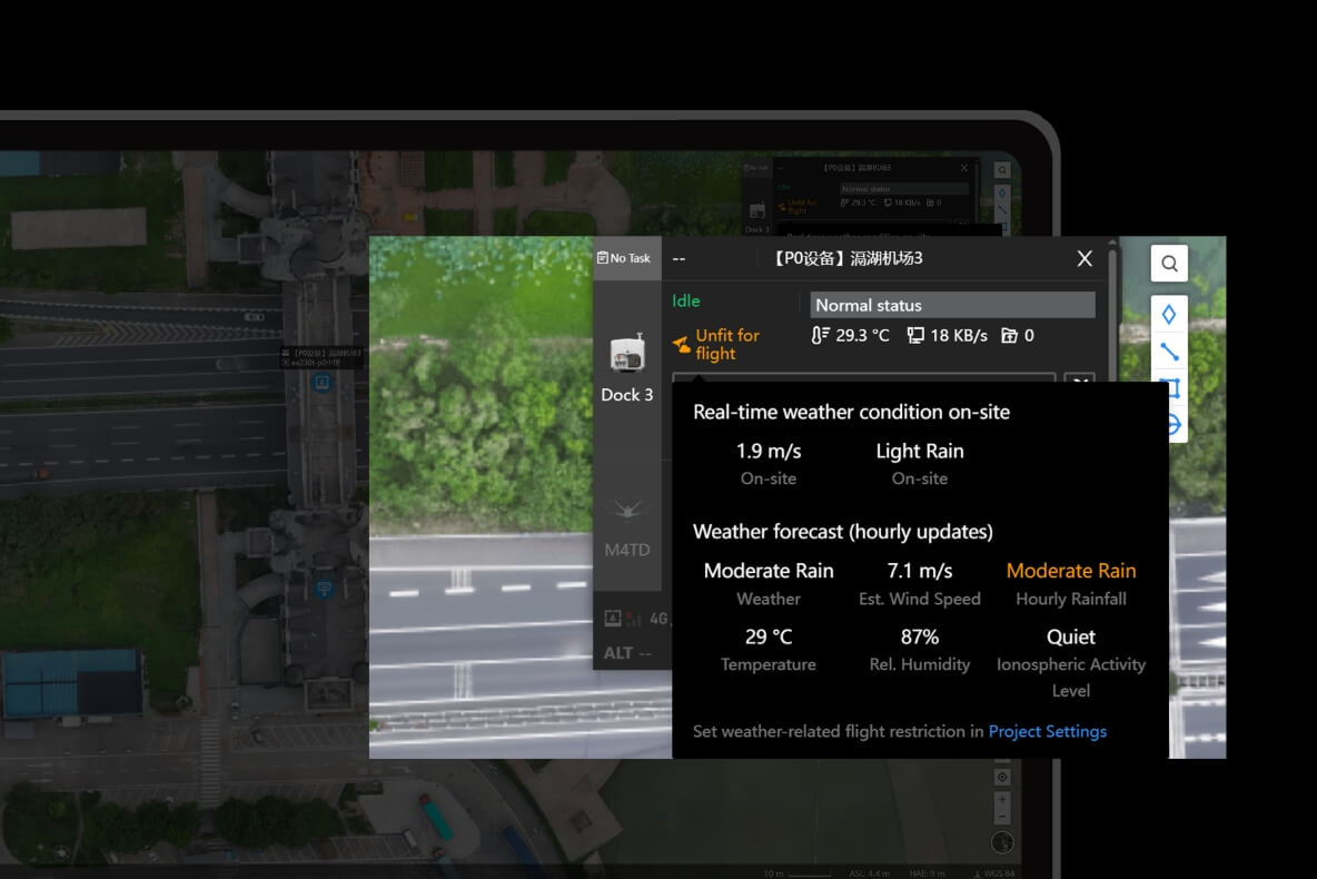
Alerts
• Auto-alerts for abnormal weather, strong winds, device risks, etc.
• Prevents mission failure and equipment damage
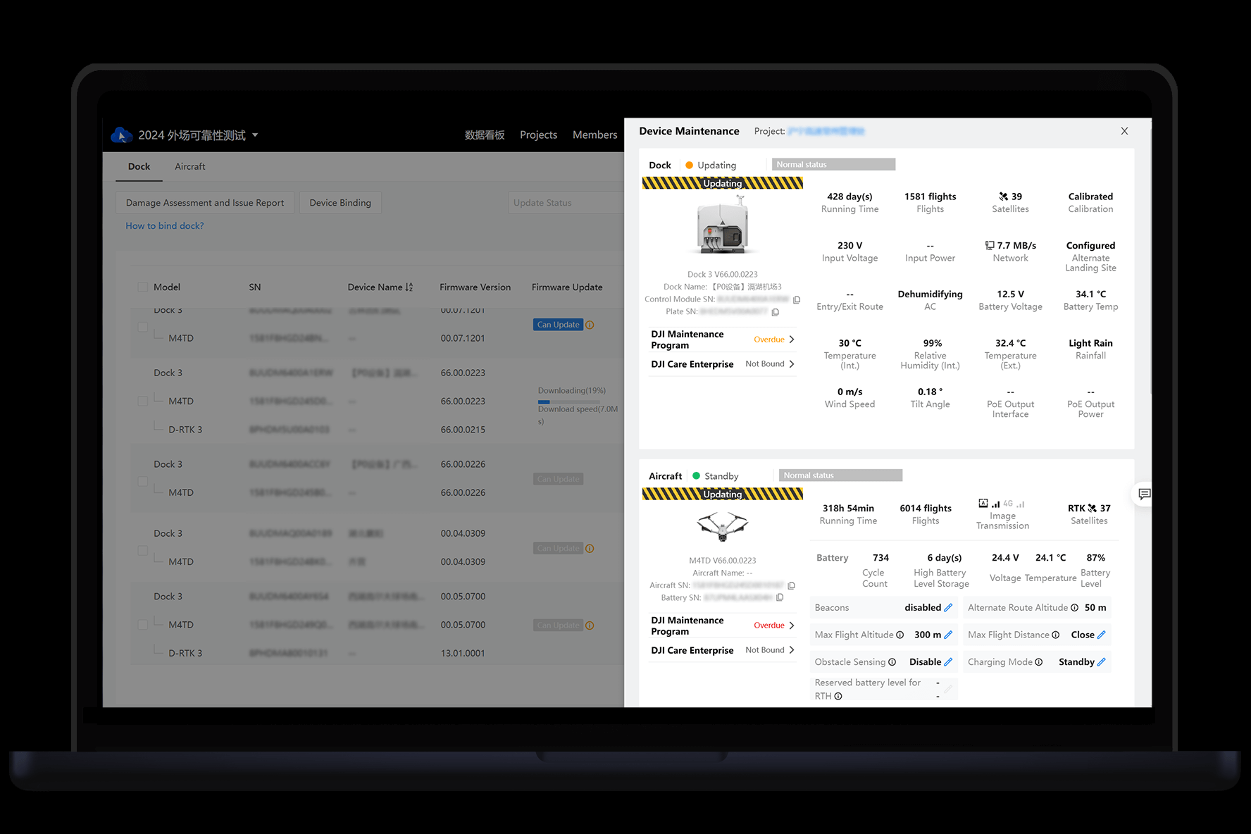
Remote Maintenance
• Check DJI Dock and drone status remotely
• Adjust settings without onsite presence → saves travel cost
11. Secure & Flexible Integration
OpenAPI
• RESTful API for direct access to core platform functions
• Easy integration with enterprise software systems
• Reduces development cost, supports custom workflows
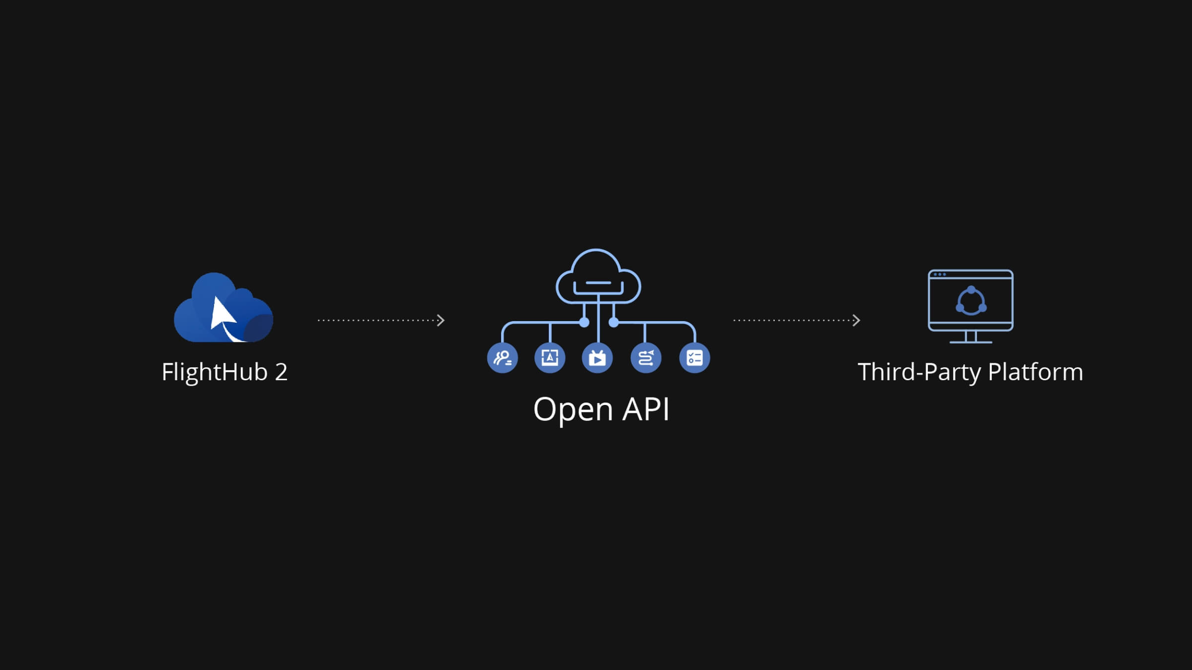
* OpenAPI capability varies between Cloud and On-Premises versions.
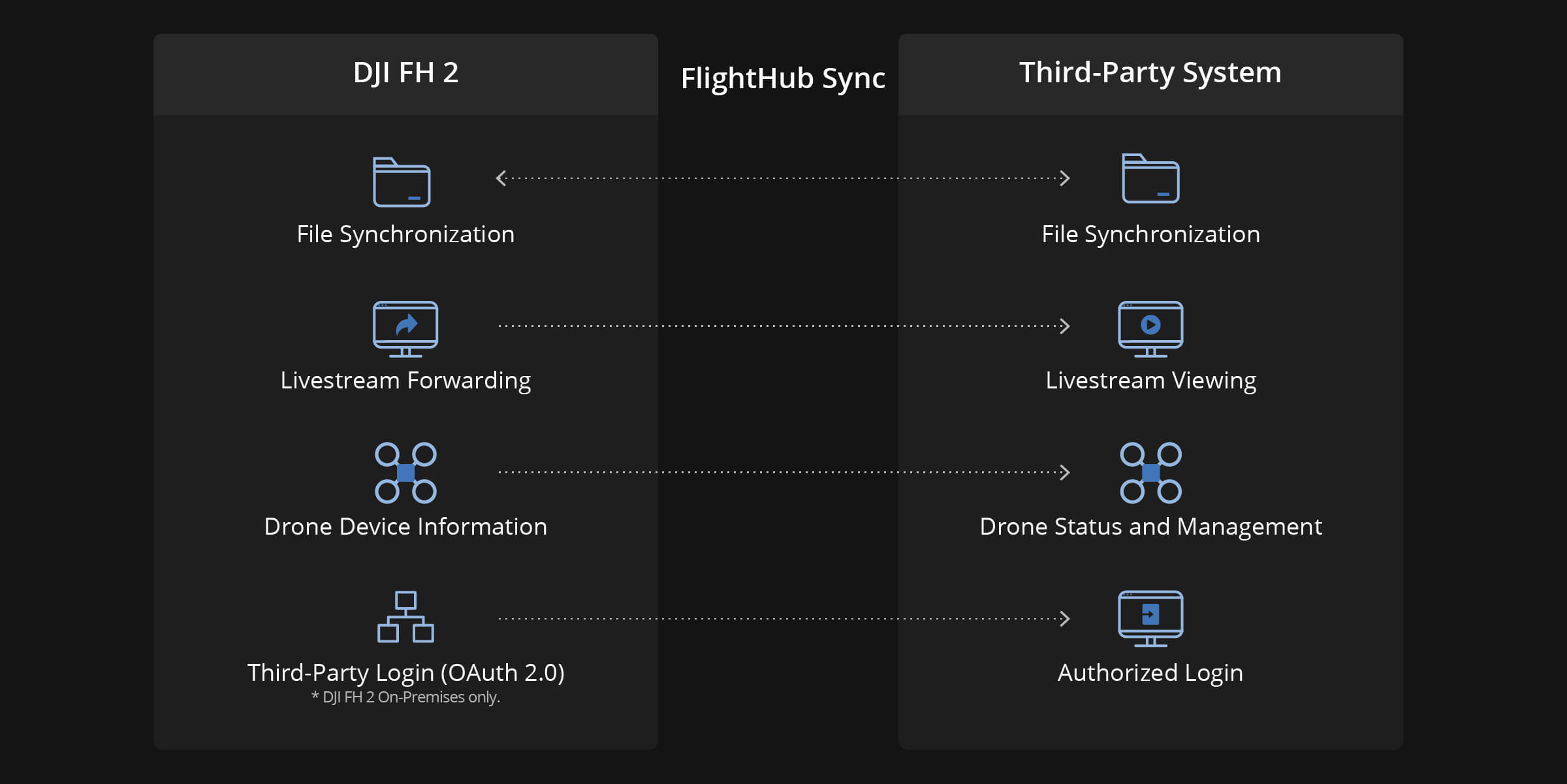
FlightHub Sync
• No-code integration via visual configuration
• Sync media, livestream, and mission data to internal systems
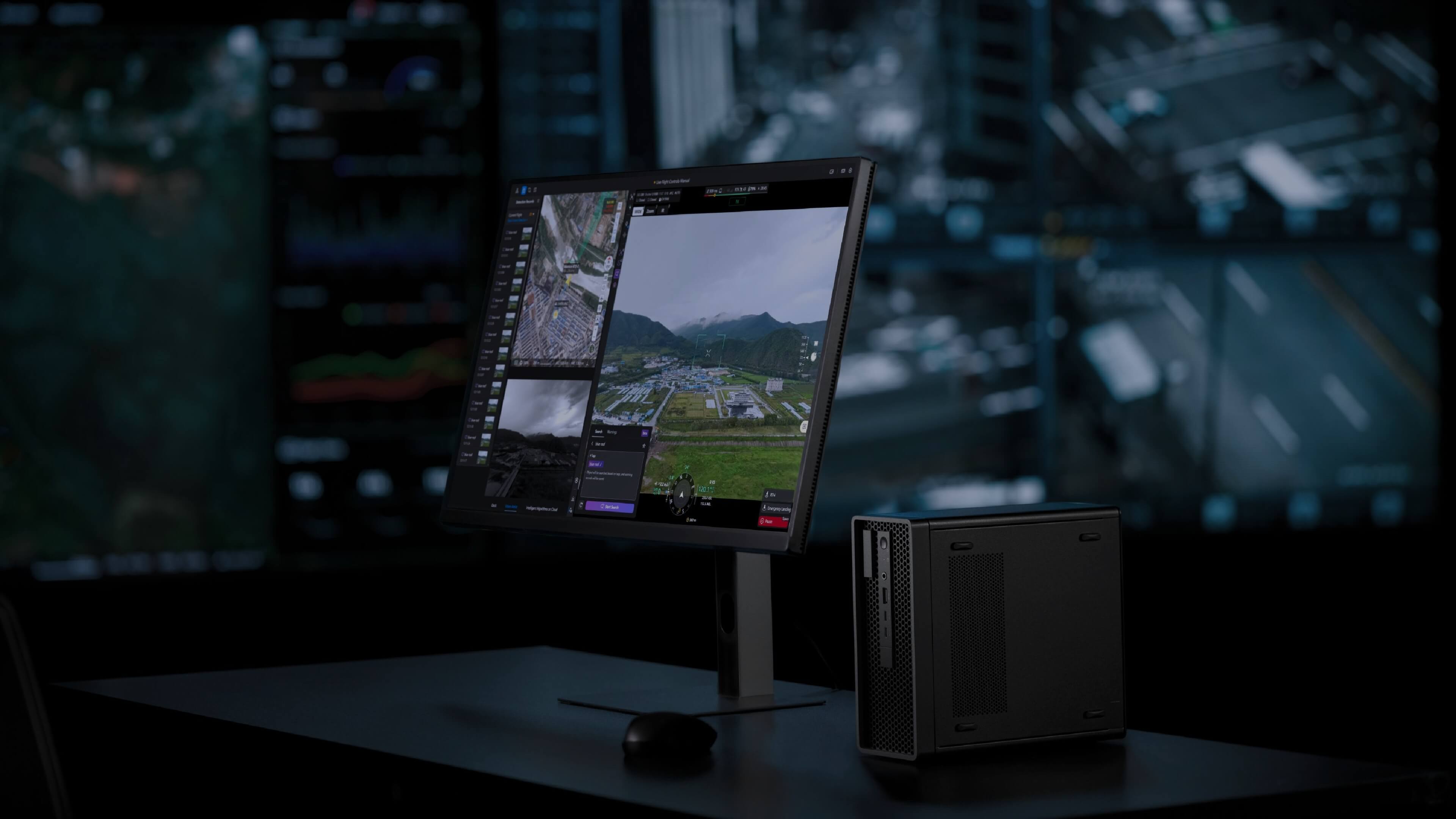
DJI FlightHub 2 On-Premises
• Private deployment and All-In-One option for organizations requiring full data control
12. Data Security
| DJI FlightHub 2 (Cloud) | DJI FlightHub 2 On-Premises | |
|---|---|---|
| Data Storage | Alibaba Cloud (China) / AWS (US & EU) | Fully local, no Internet dependency |
| Security Certifications | ISO/IEC 27001, ISO 27701 | ISO/IEC 27001, ISO 27701 (system level) |
| Protection Level | Global-standard cloud security | Completely isolated intranet |
| Privacy Control | Compliant with international data & privacy laws | 100% self-managed by enterprise |
13. Supported Devices
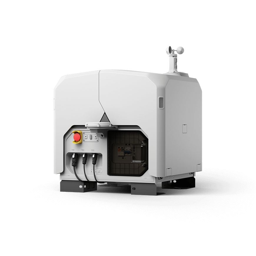
DJI Dock 2
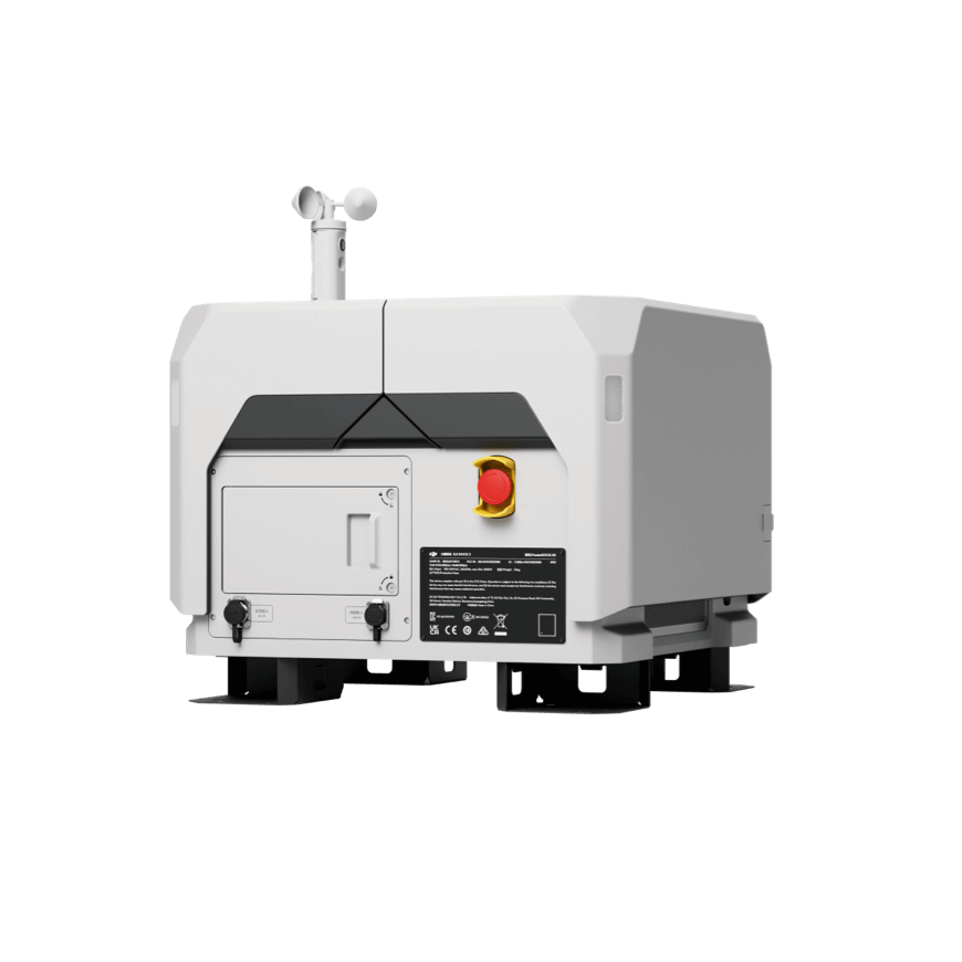
DJI Dock 3
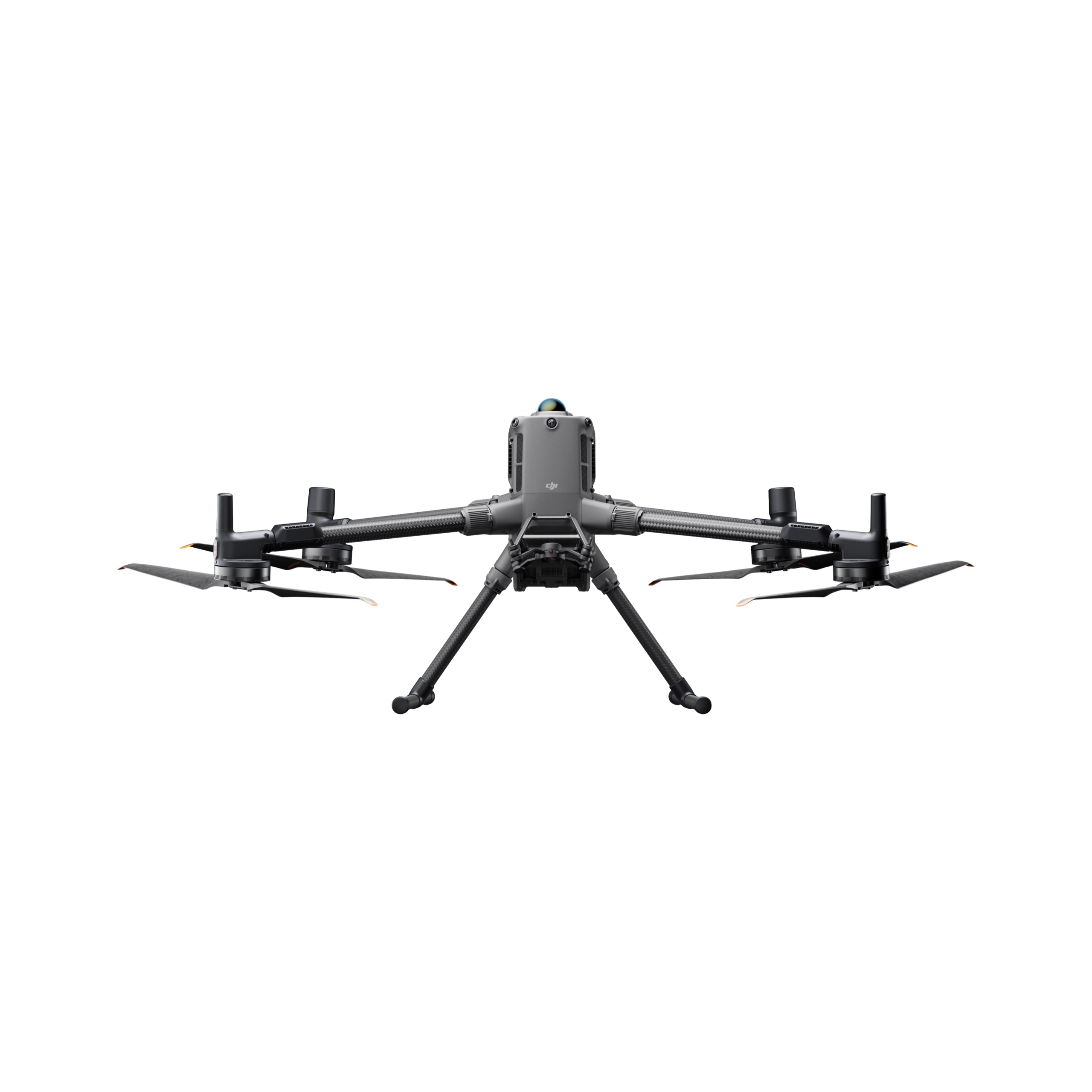
DJI Matrice 400
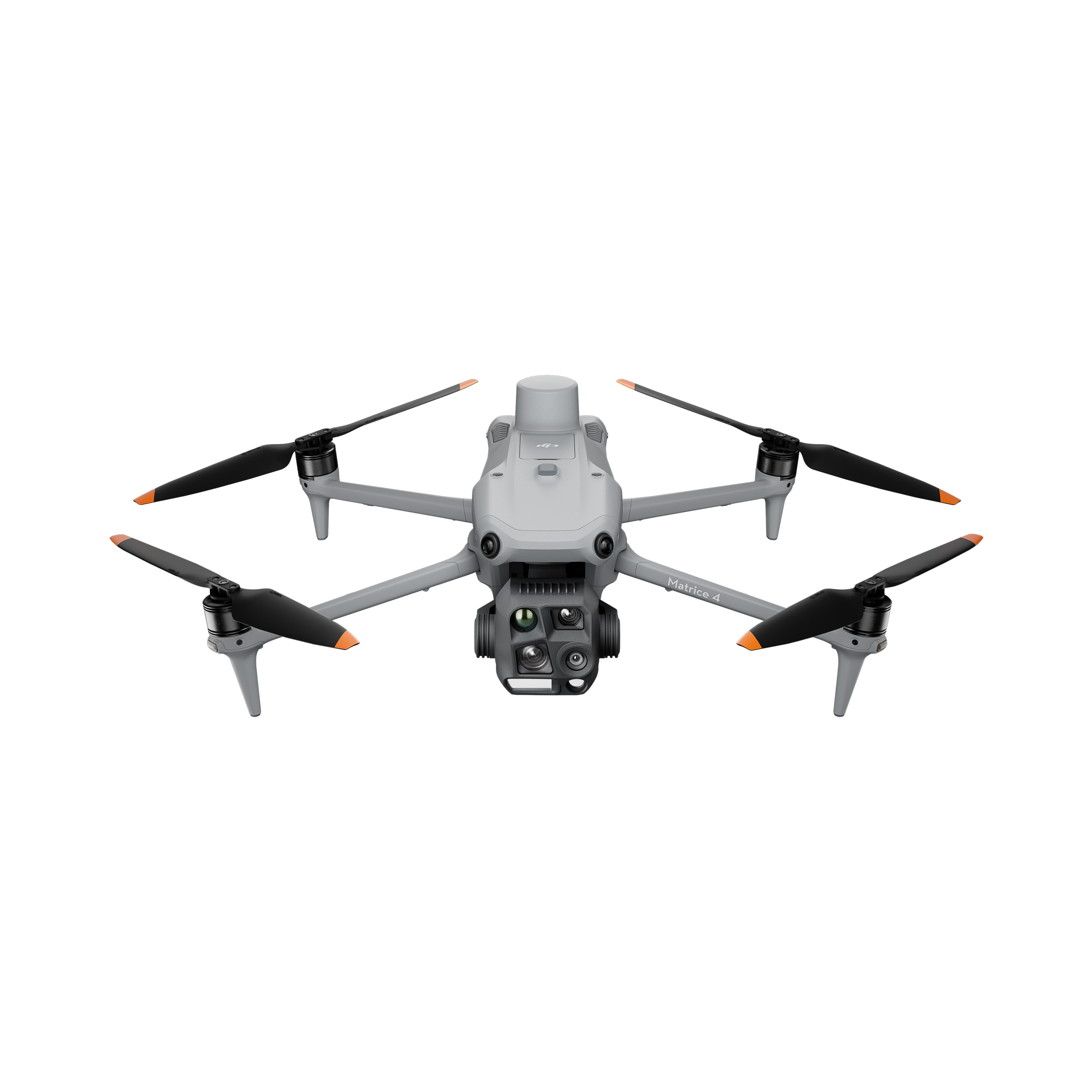
DJI Matrice 4 Series
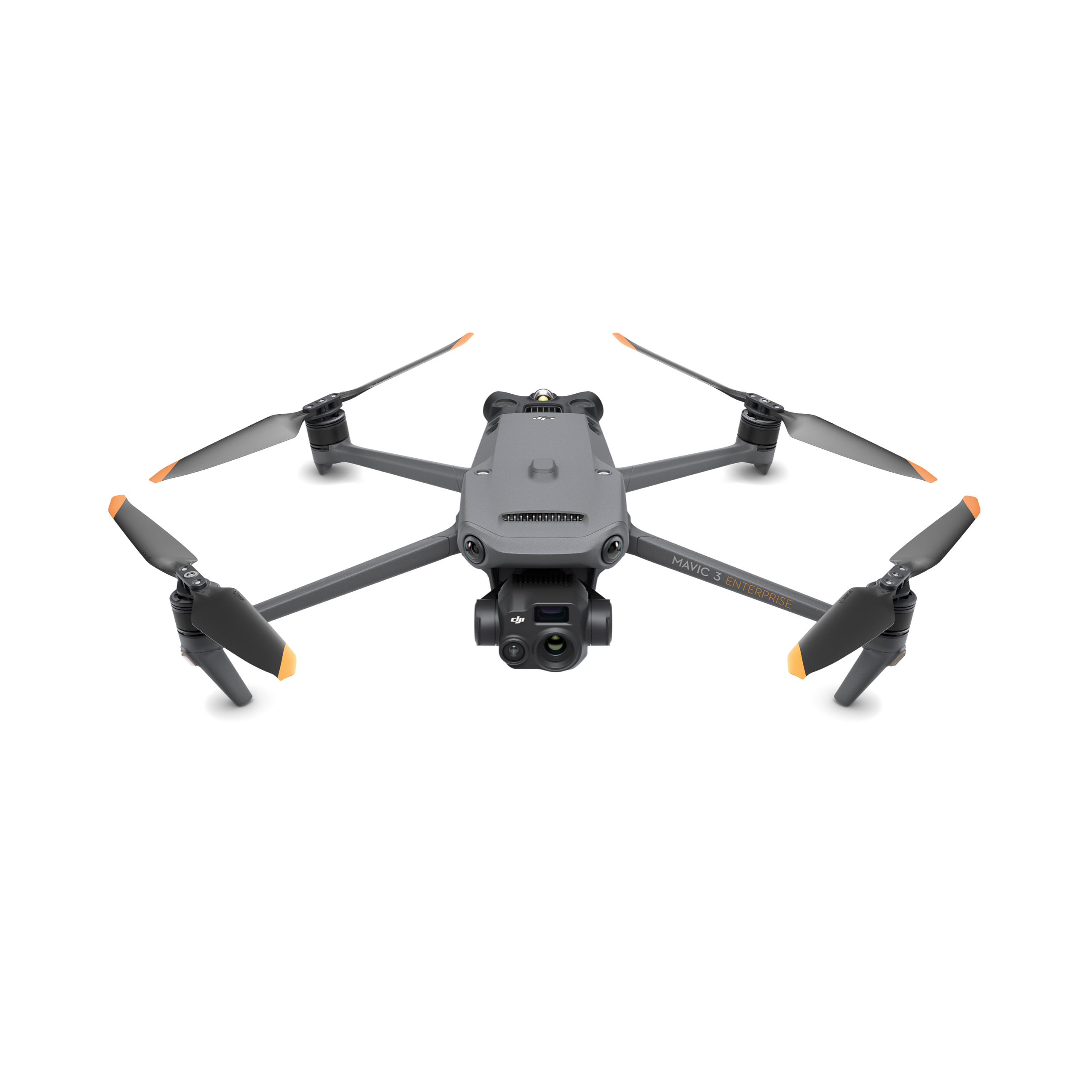
DJI Mavic 3 Enterprise Series
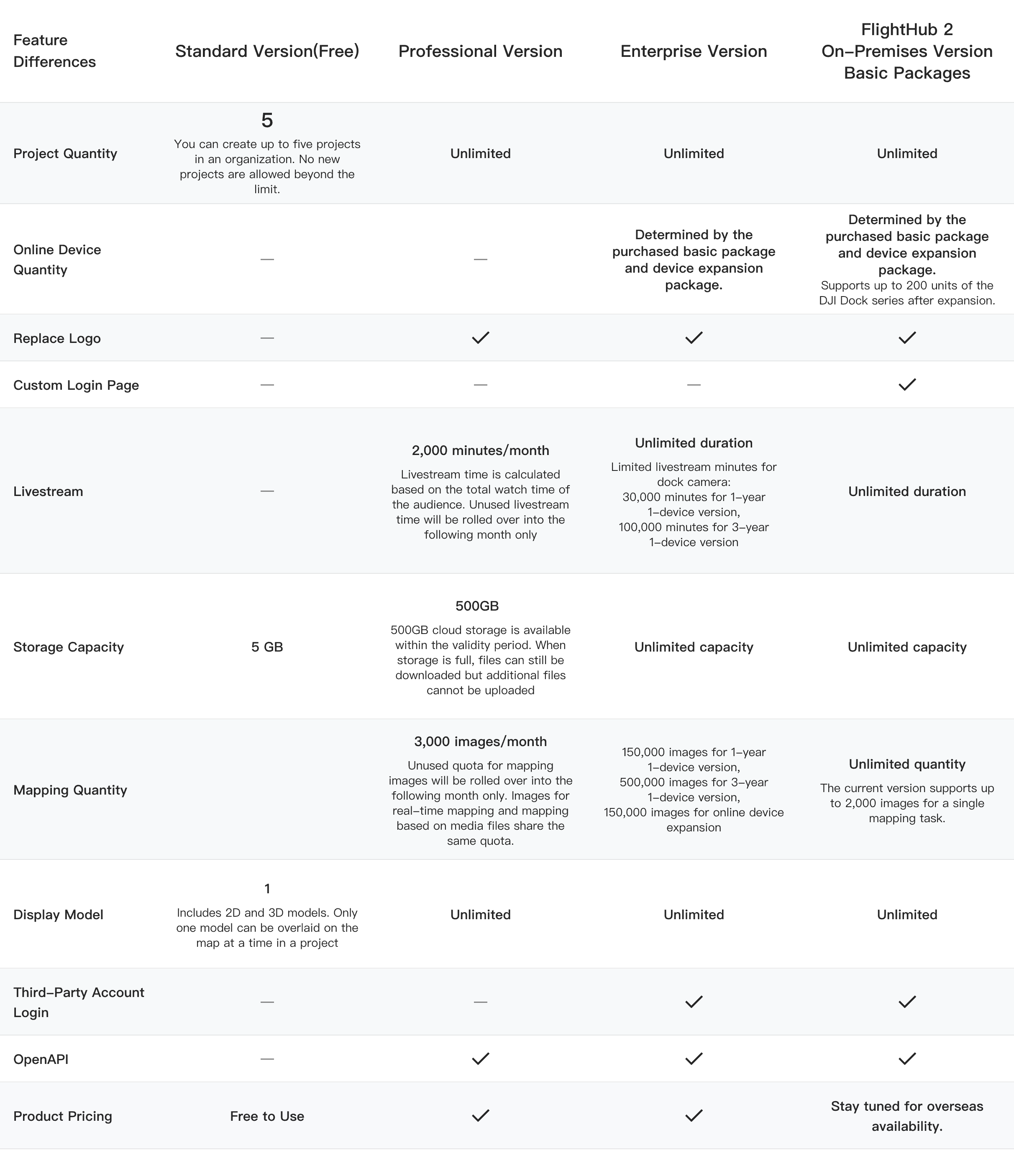
Compare differences between plans