Zenmuse L3
Zenmuse L3 is DJI’s next-generation aerial LiDAR system, featuring an exceptional ranging capability of up to 950 m, even on surfaces with only 10% reflectivity, paired with dual 100MP RGB cameras and a high-precision POS system. With a fully integrated hardware–software ecosystem, Zenmuse L3 enables large-scale geospatial data acquisition at remarkable speed—up to 100 km² per day.
Product prices displayed on the website do not include VAT. VAT will be applied at the rate prescribed by the State at the applicable time.
Shipping fees (if any) are calculated based on the destination, weight and order value, and will be displayed at checkout before the customer confirms the order.
ZENMUSE L3
Zenmuse L3 is DJI’s next-generation aerial LiDAR system, featuring an exceptional ranging capability of up to 950 m, even on surfaces with only 10% reflectivity, paired with dual 100MP RGB cameras and a high-precision POS system. With a fully integrated hardware–software ecosystem, Zenmuse L3 enables large-scale geospatial data acquisition at remarkable speed—up to 100 km² per day.
Hardware Performance – Redefining Excellence
Zenmuse L3 integrates a long-range 1535 nm LiDAR, dual 100MP RGB cameras, a high-precision POS system, and a 3-axis gimbal into a compact device. Everything works together to deliver best-in-class performance.
1535 nm Long-Range LiDAR – Extended Range, Superior Coverage
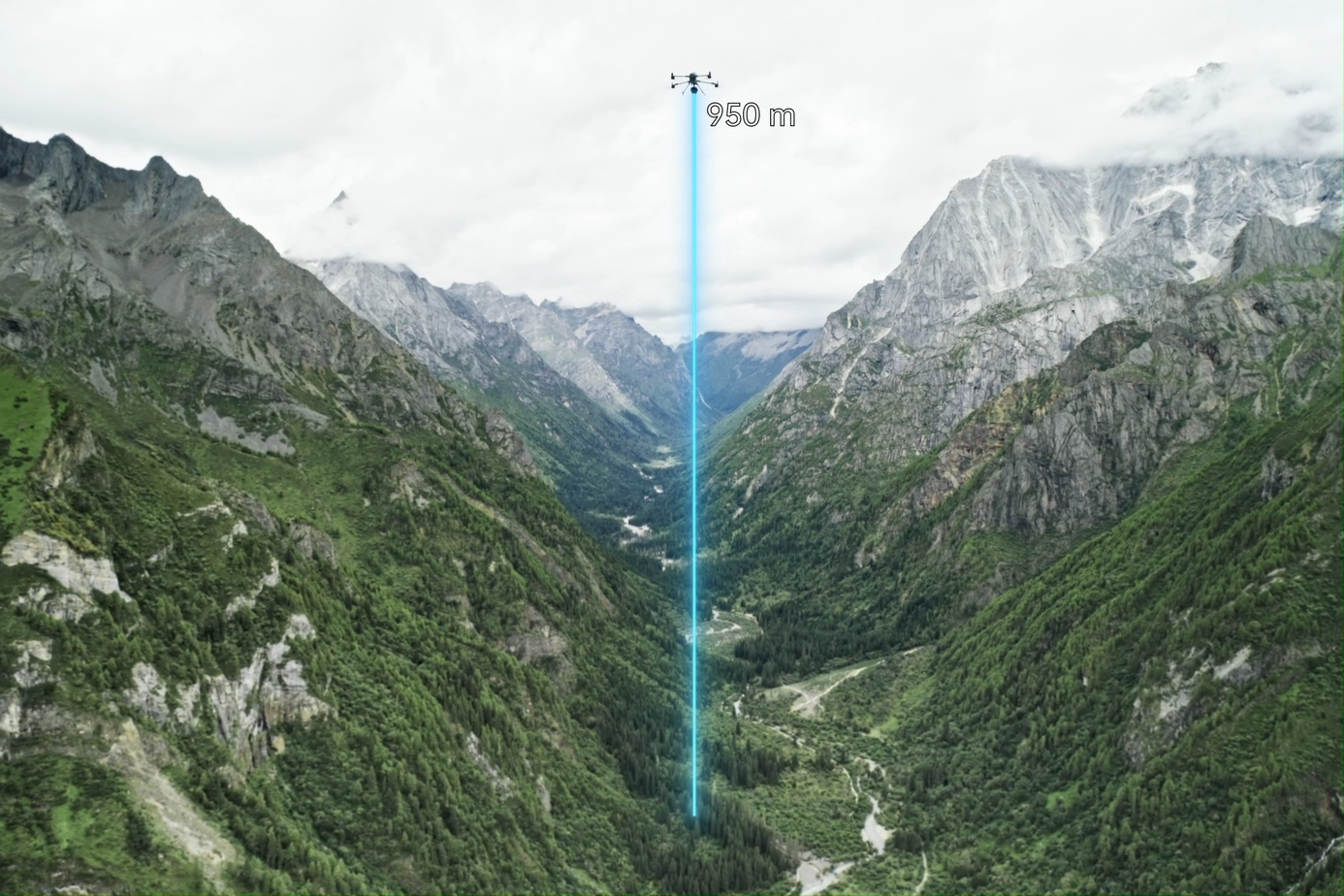
950 m Ranging Distance
Optimized for flight altitudes of 300–500 m.
Performs reliably even under 100 klx strong ambient light
Measures well on surfaces with 10% reflectivity
Adjustable pulse rate for mission-optimized performance
→ Result: greater coverage per flight, significantly improving mapping efficiency.
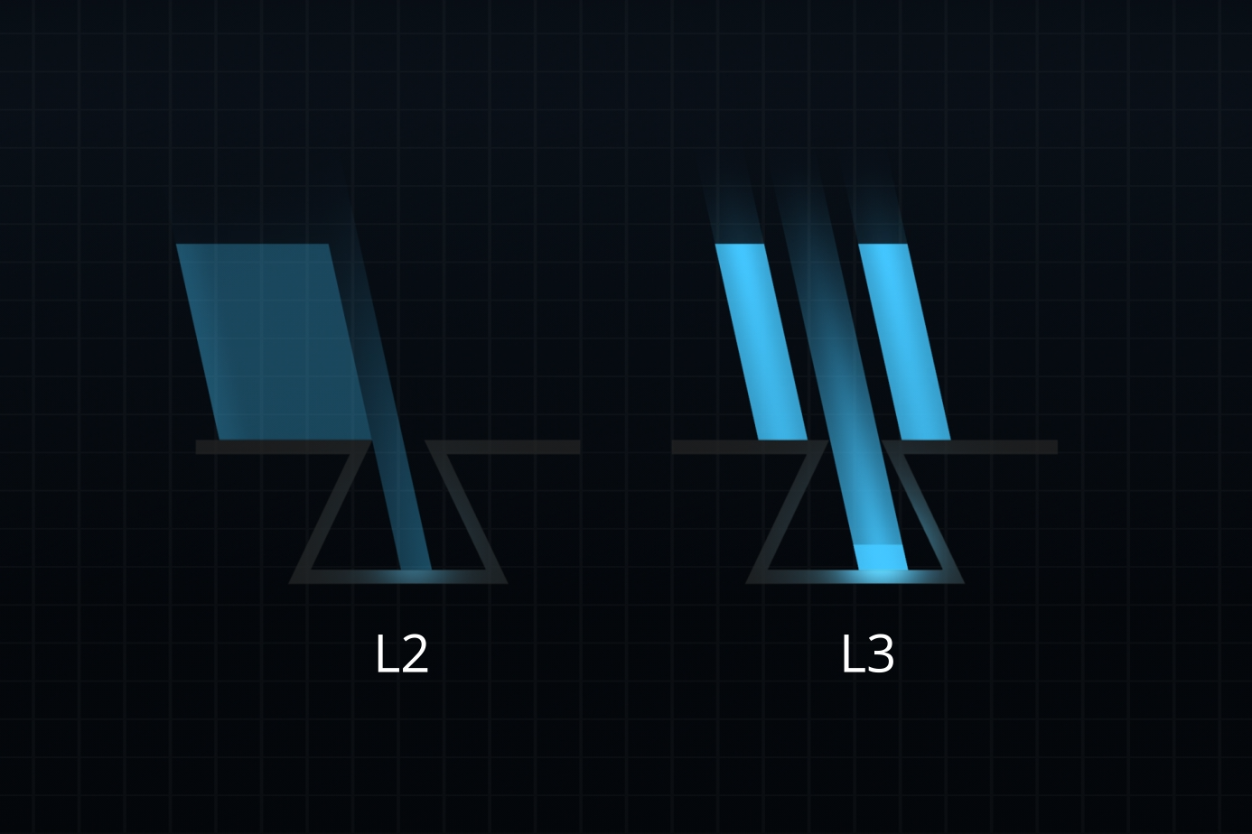
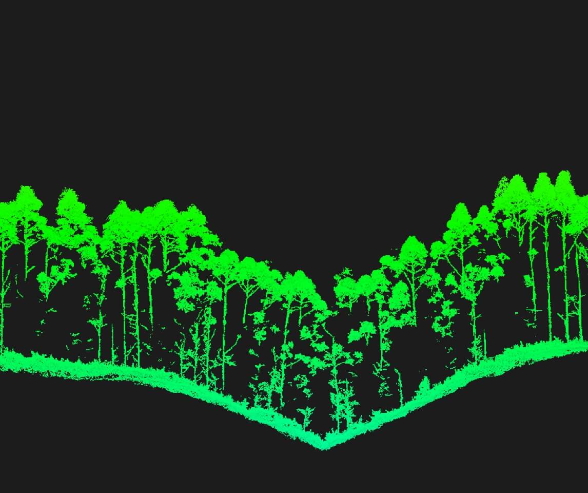
Small Laser Spot – High Energy
Beam divergence of only 0.25 mrad → scan area 1/5 the size of the L2
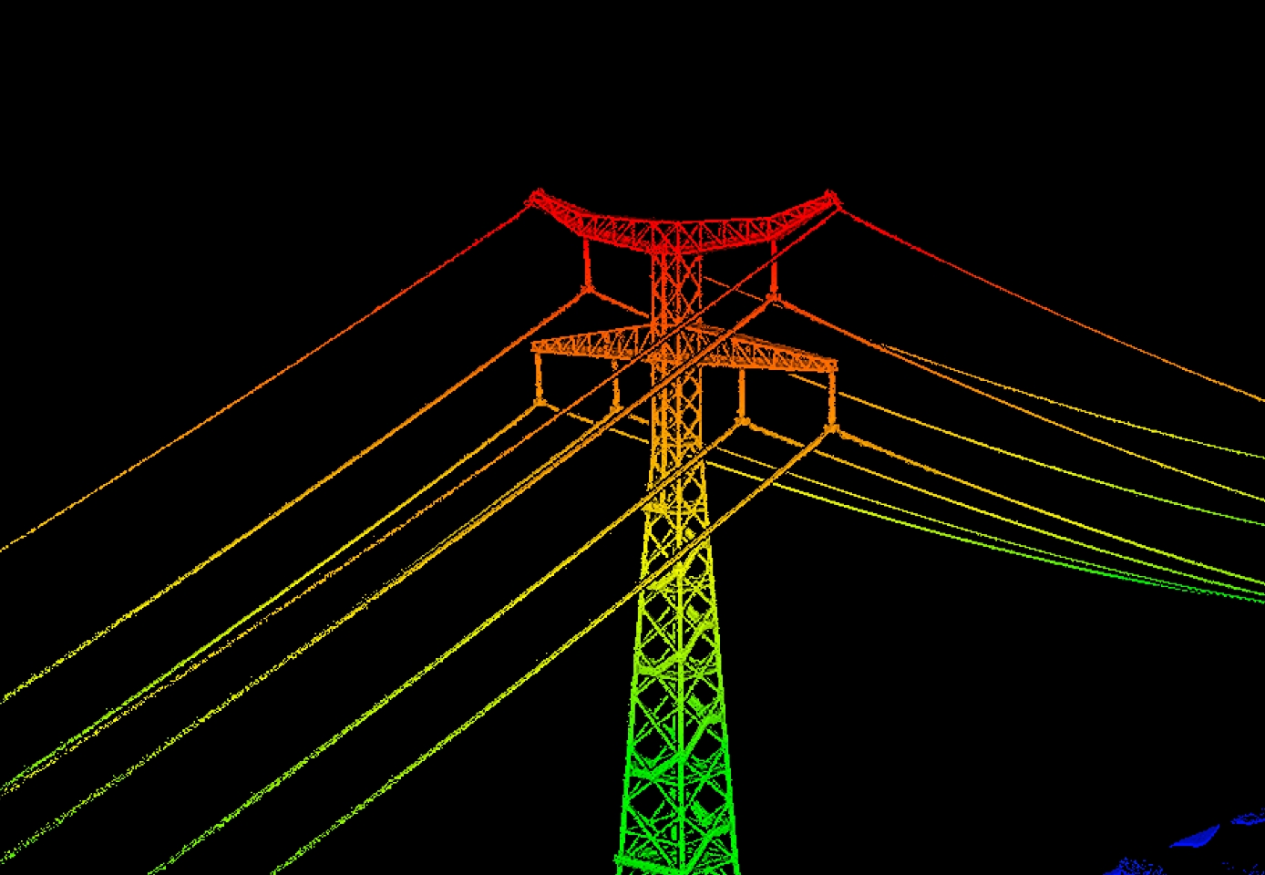
Captures tiny details such as power lines and thin branches
Strong penetration through vegetation, retrieving more ground points beneath canopy
High Pulse Rate – Up to 2 Million Pulses per Second, Supporting 16 Returns
→ Enables extremely detailed 3D reconstruction, ideal for high-precision terrain mapping and complex structural surveys.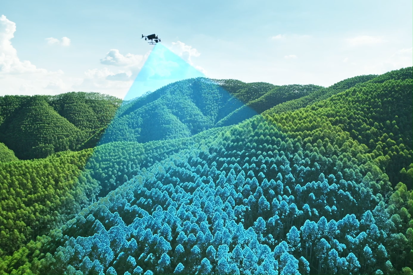
Three Flexible Scan Modes
Linear Mode
Uniform point distribution, optimized for high-precision topographic surveys.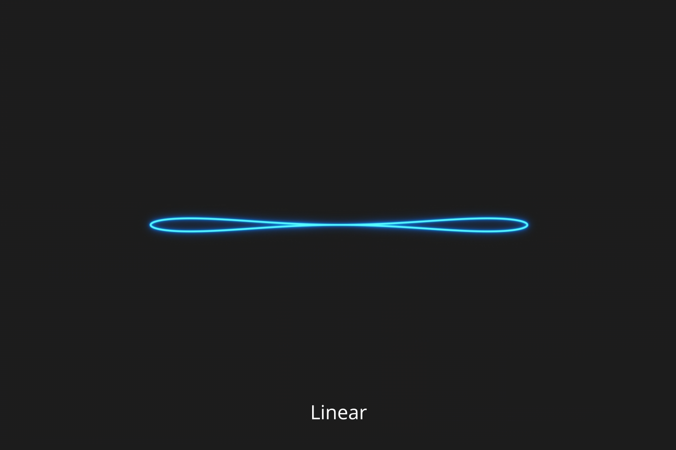
Star-Shaped Mode
Balances accuracy and penetration—ideal for forests and dense urban areas.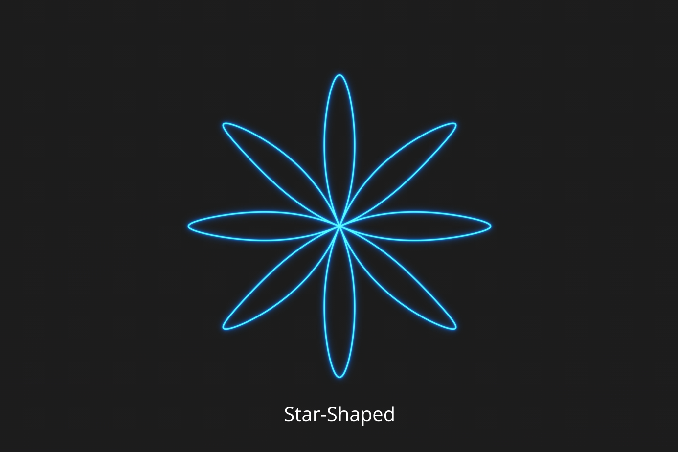
Non-Repetitive Mode
Multiple scan angles, wide coverage—perfect for power line inspections and complex structures.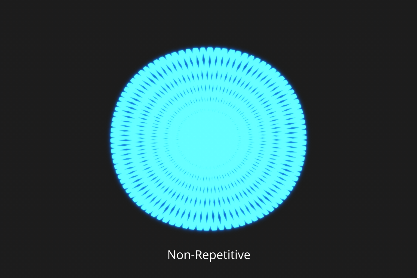
Dual 100MP RGB Cameras – Ultra-Wide, Ultra-Clear, Ultra-Efficient
4/3 CMOS sensors, mechanical shutter
Supports pixel binning → effective 25MP high-quality images in low light
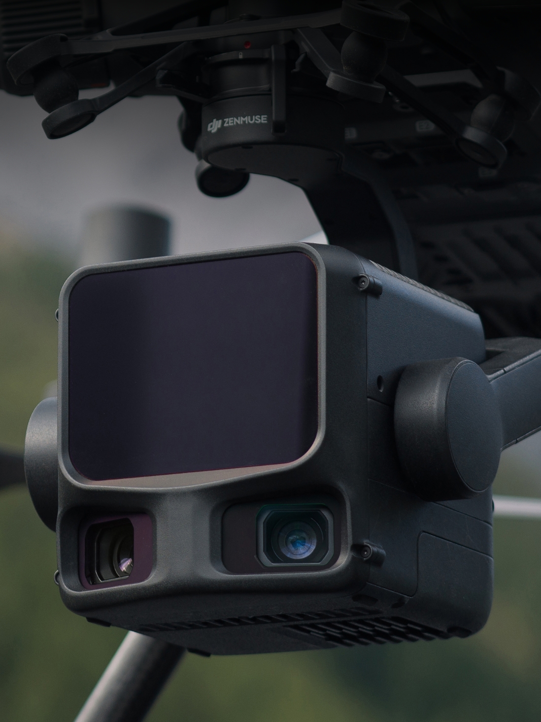
107° ultra-wide FOV → very large area covered per capture
With only 20% LiDAR sidelap, a single mission generates complete DOM & DEM
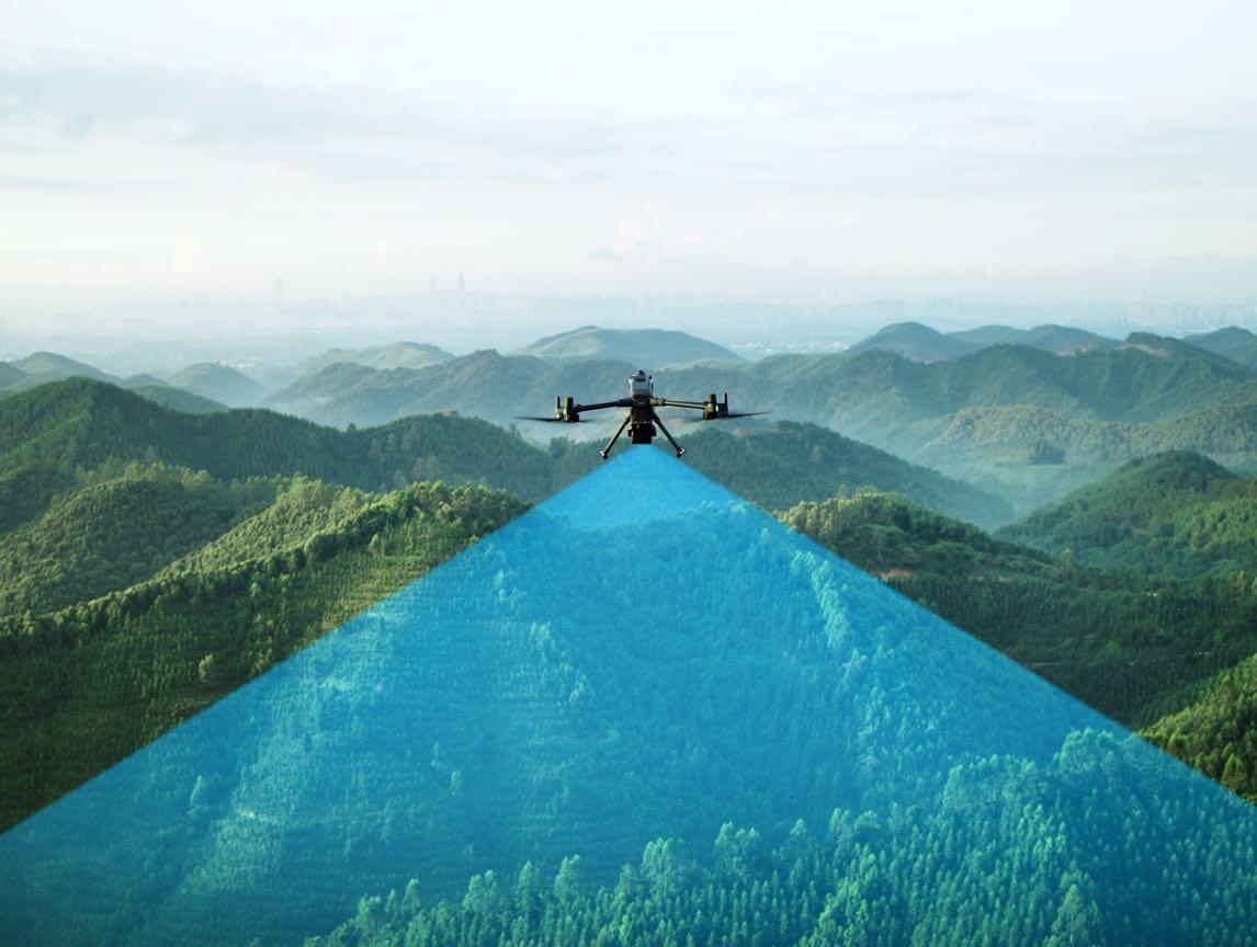
Maximum Efficiency
Combined with Matrice 400, each flight can cover up to 10 km², achieving 100 km² per day.
High Accuracy – Professional Survey-Grade
Next-Generation POS System
Heading accuracy: 0.02°
Pitch accuracy: 0.01° (post-processed, 1σ)
LiDAR range repeatability: 5 mm at 150 m
LiDAR Data Accuracy
Vertical error < 3 cm at 120 m
< 5 cm at 300 m
< 10 cm at 500 m
→ Meets 1:500 / 1:1000 / 1:2000 mapping standards.
Point clouds from L3 are over 2× thinner than L2, supporting advanced analysis.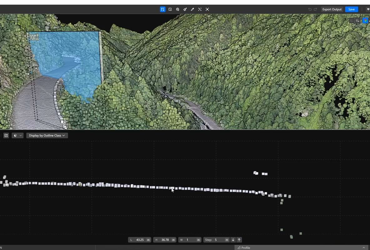
Photogrammetry Accuracy
GSD 3 cm at 300 m altitude
No GCPs required thanks to real-time synchronized positioning
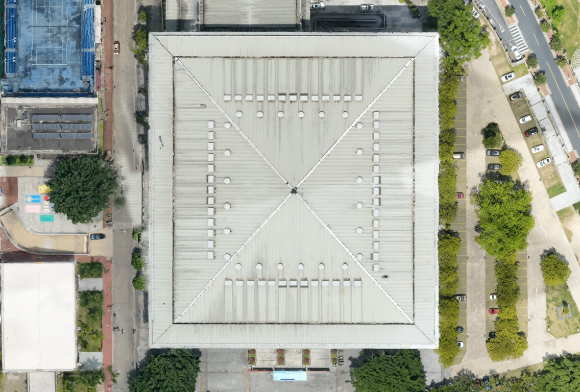
Penetration Capability – More Accurate Ground Data
Thanks to the small laser spot and high pulse energy, L3:
Captures more ground points
Maintains high completeness under vegetation
Improves DEM accuracy and surface reconstruction
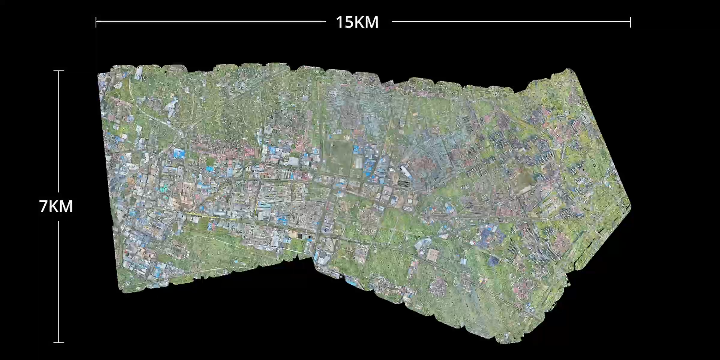
High Efficiency – Large-Scale Mapping Performance
Coverage up to 100 km² per day
With DJI Matrice 400:
10 km² per flight at 300 m altitude
Stable operation supports 100 km² per day
→ Ideal for large-area surveys and high-speed mapping tasks.
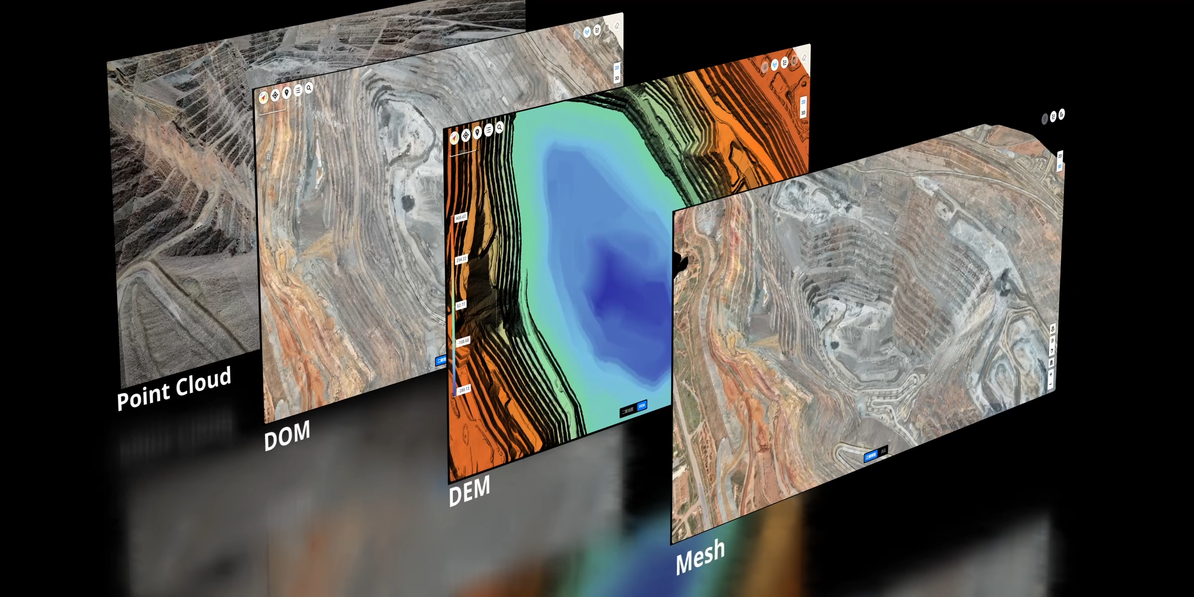
Multiple Data Types in a Single Flight
Zenmuse L3 simultaneously collects LiDAR and RGB data, enabling production of:
DEM (Digital Elevation Model)
DOM (Digital Orthophoto Map)
And various survey-grade datasets
A seamless workflow—from acquisition to processing to application—much simpler than multi-platform systems.
Intelligent Data Acquisition Experience
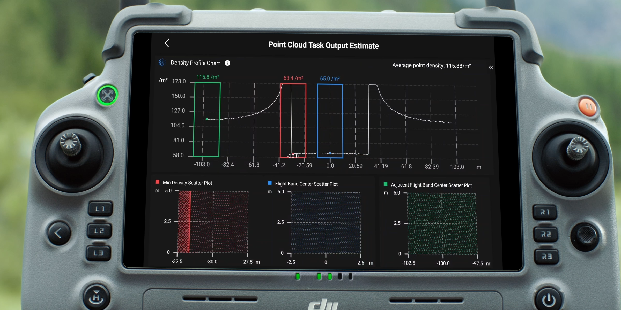
Point Cloud Preview
DJI Pilot 2 automatically recommends flight parameters based on the planned route.
Before takeoff, the system displays:
Point density chart
Point cloud distribution map
→ Helps evaluate expected data quality in advance.
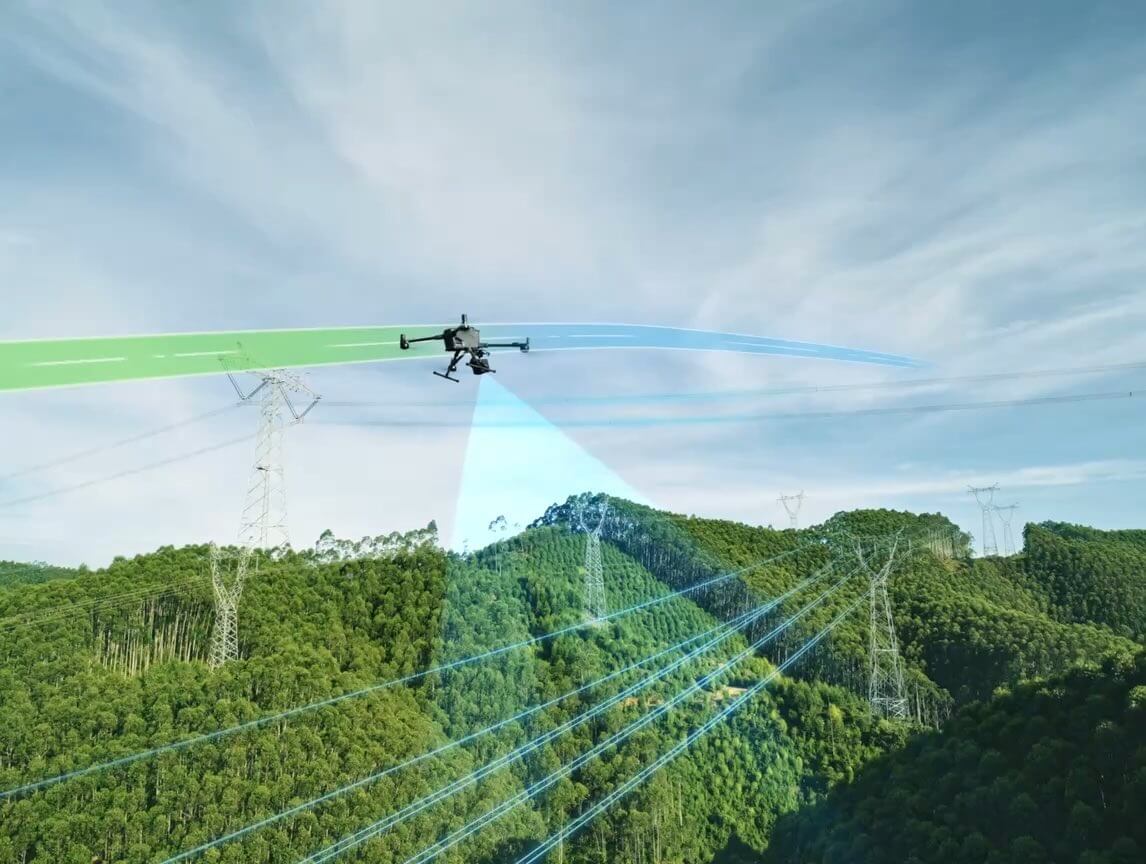
Power Line Follow – Optimized for Power Line Inspection
DJI Pilot 2 suggests optimal parameters for power line routes.
Users can preview point cloud distribution for each segment to ensure detailed capture of:
Lines
Towers
Suspended structures
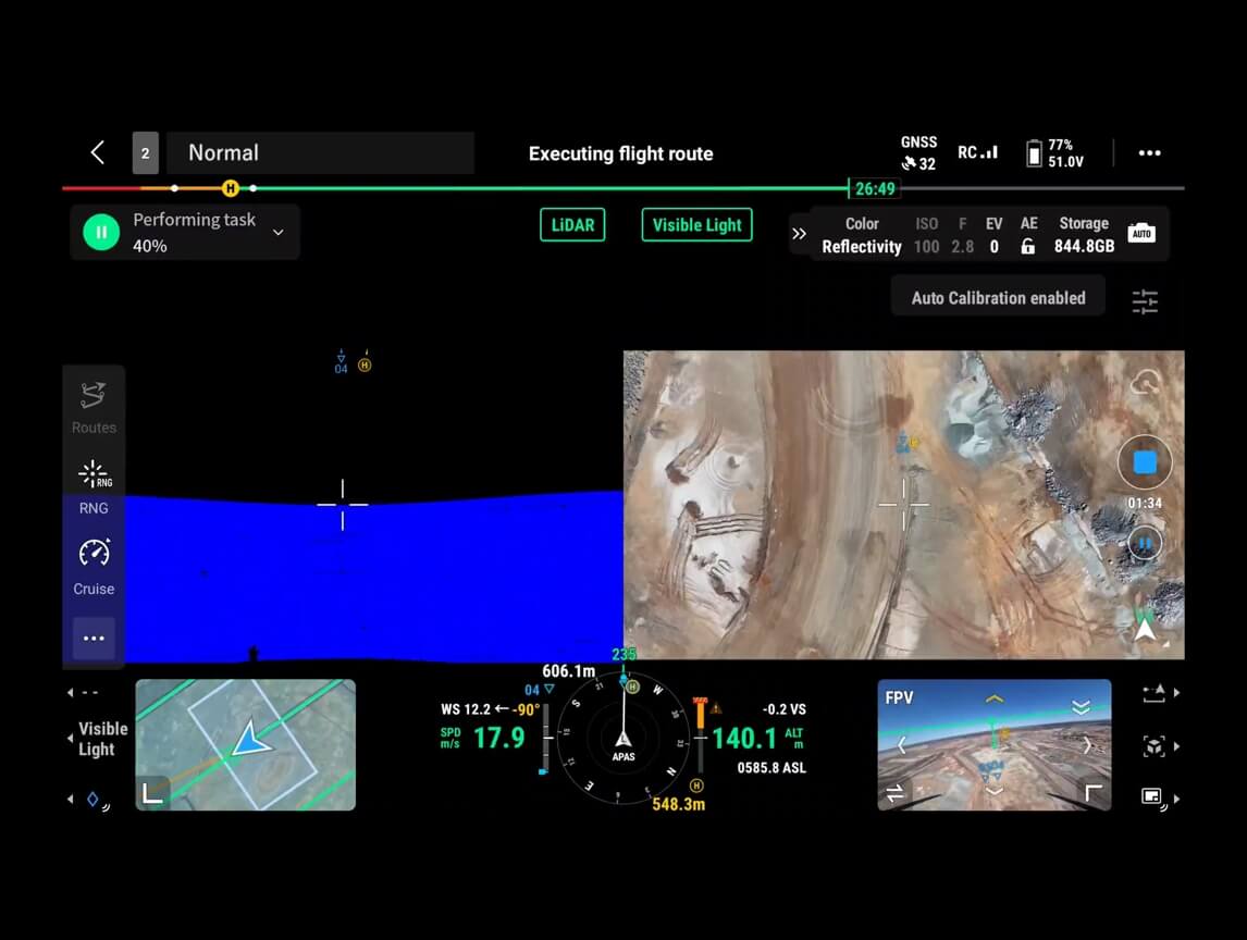
Flexible Split-Screen View
Pilot 2 supports side-by-side viewing of any two data sources:
Point Cloud
RGB
Vision Assist
Vision Assist provides a forward-facing view when the RGB camera is angled downward—reducing risk and improving safety.
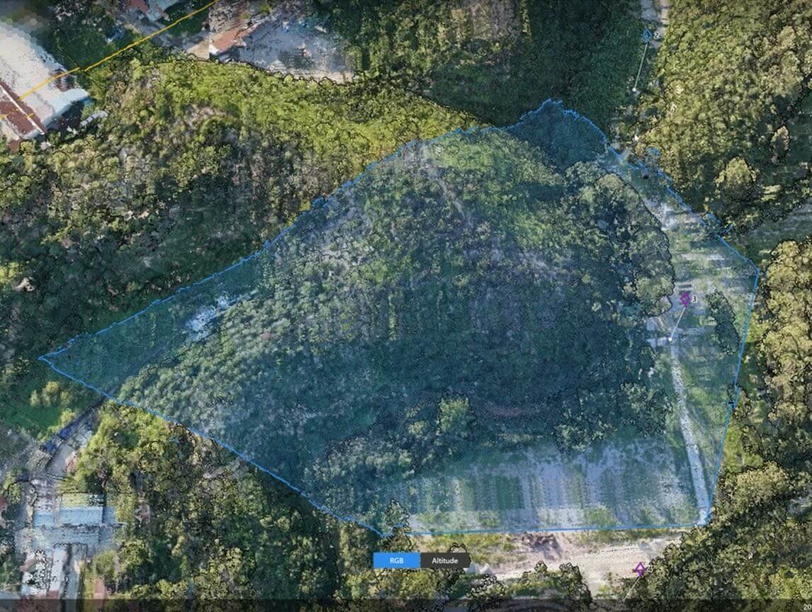
Real-Time Point Cloud
Zenmuse L3 supports real-time SLAM point cloud, displaying live 2D and 3D models during flight.
Users can:
Track collection progress
Measure directly in real time
Sync point cloud instantly to DJI FlightHub 2 for rapid response in emergencies or field missions

Cloud-Based Point Cloud Measurement
Compatible with FlightHub 2 for:
Real-time point cloud viewing & management
Detailed route planning
Marking & sharing key points
Measuring area, length, and volume directly on the cloud
Data Processing – Fast, Accurate, Complete
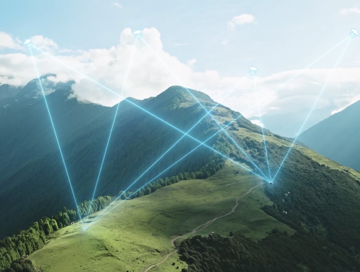
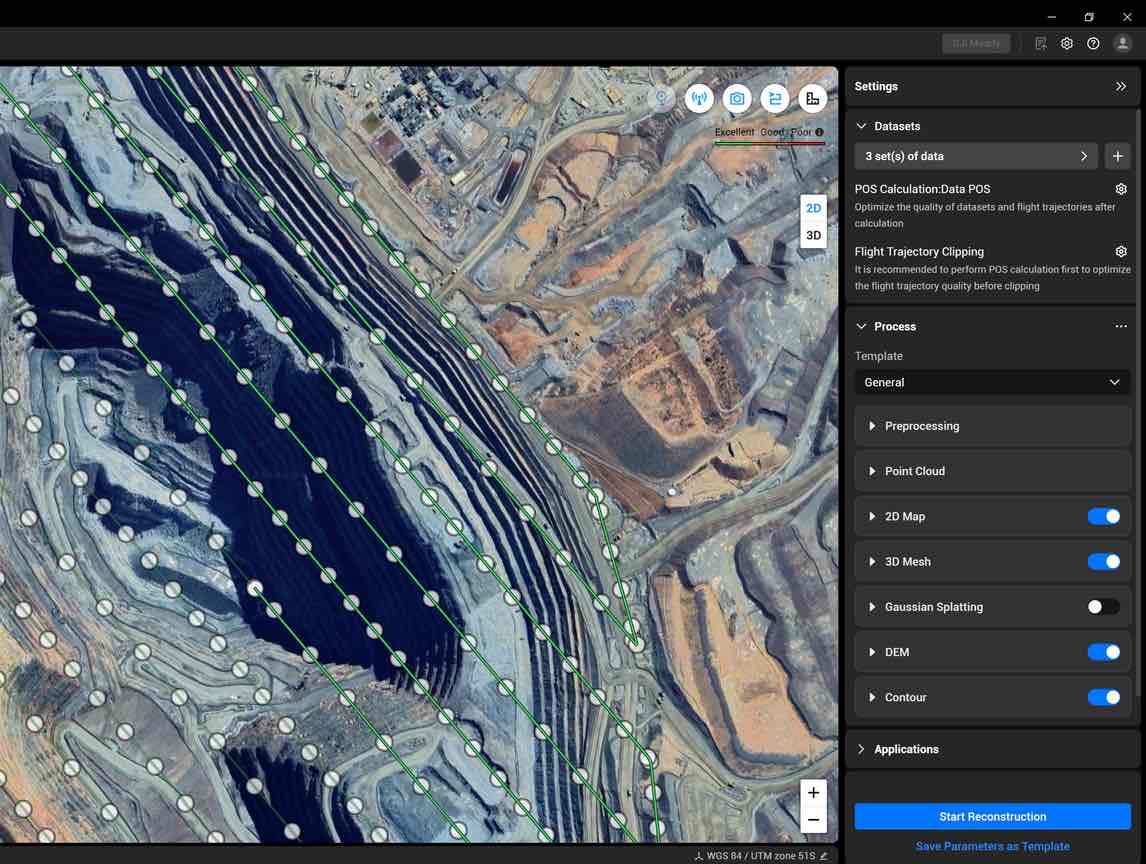
Integrated PPK Processing
DJI Terra supports robust PPK, compatible with:
D-RTK 3 Mobile Station
Standard base station data
L3 achieves centimeter-level accuracy even without RTK signal or network connectivity.
LiDAR Gaussian Splatting & Fusion Modeling
DJI Terra supports:
LiDAR reconstruction using Gaussian Splatting
Fusion-based modeling
→ Produces smoother, more detailed, and more realistic 3D models.
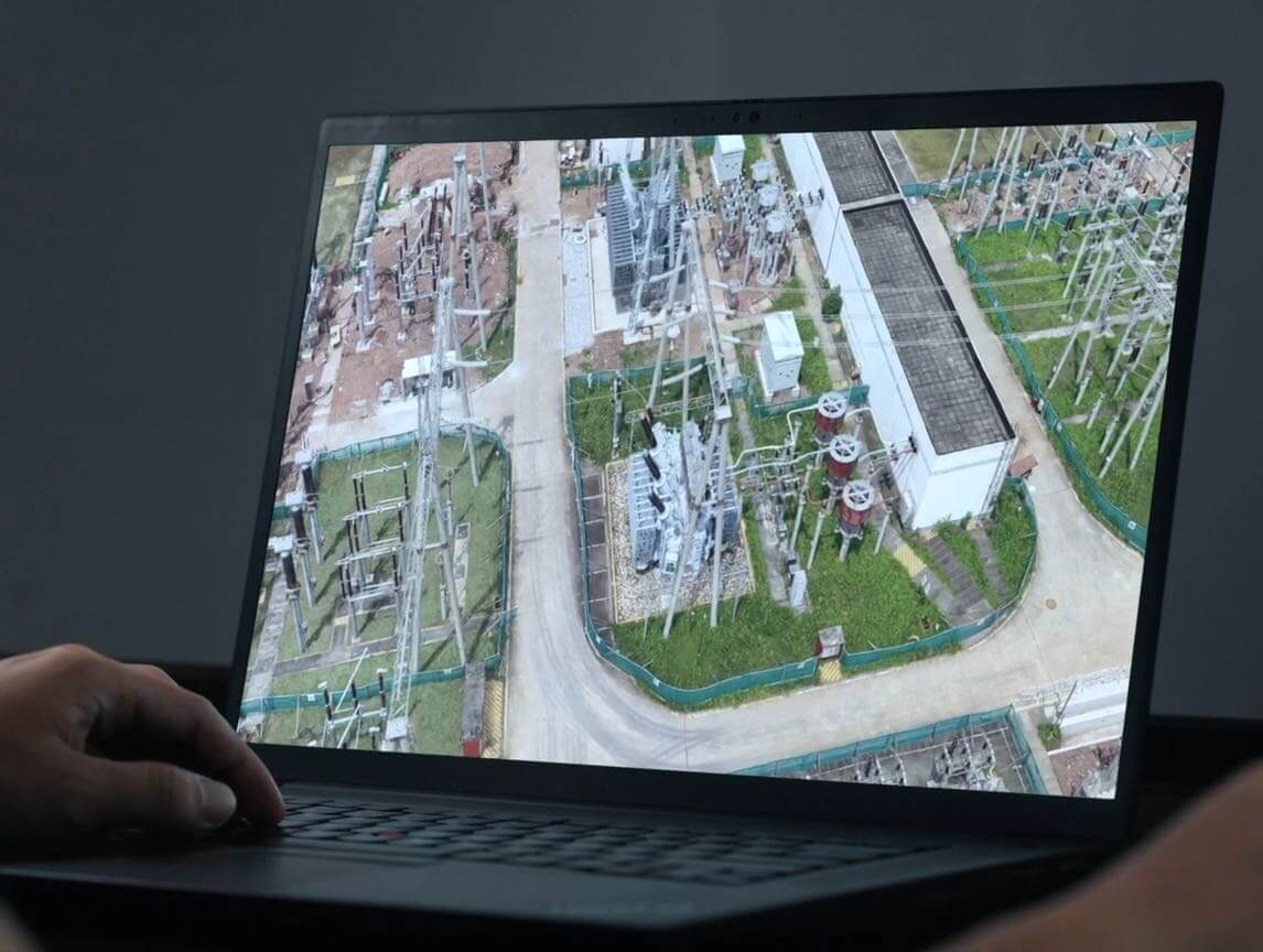
Fusion-Based Modeling – RGB + LiDAR Unified
Using DJI Terra, users can deeply integrate LiDAR and RGB data to generate:
High-accuracy point cloud
Orthomosaic map
Full 3D mesh
Benefits:
More complete models
High detail in complex areas (bridges, substations, transportation structures)
Better color and geometry consistency
Suitable for energy, transportation, construction, and infrastructure industries.
Data Application
Smart Filter – Intelligent Semantic Classification
DJI Modify automatically identifies and separates:
Ground
Vegetation
Buildings
Power lines
Utility poles
Other objects
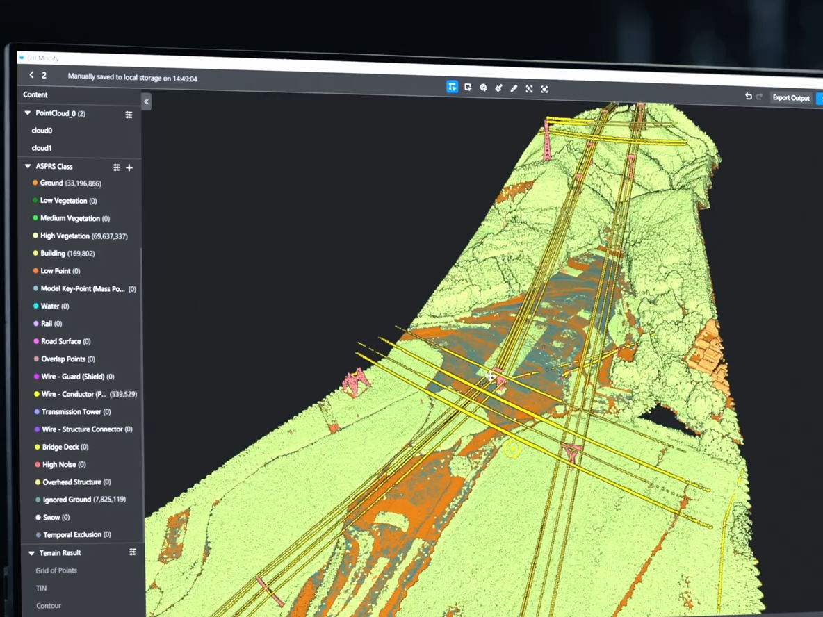
Users can refine results with Quick Selection and Structure Selection for high-efficiency processing.
Profile Tool – Detailed Cross-Section Analysis
DJI Modify allows flexible selection of point cloud cross-sections to:
Analyze terrain changes
Measure construction features
View elevation, slope, and structure
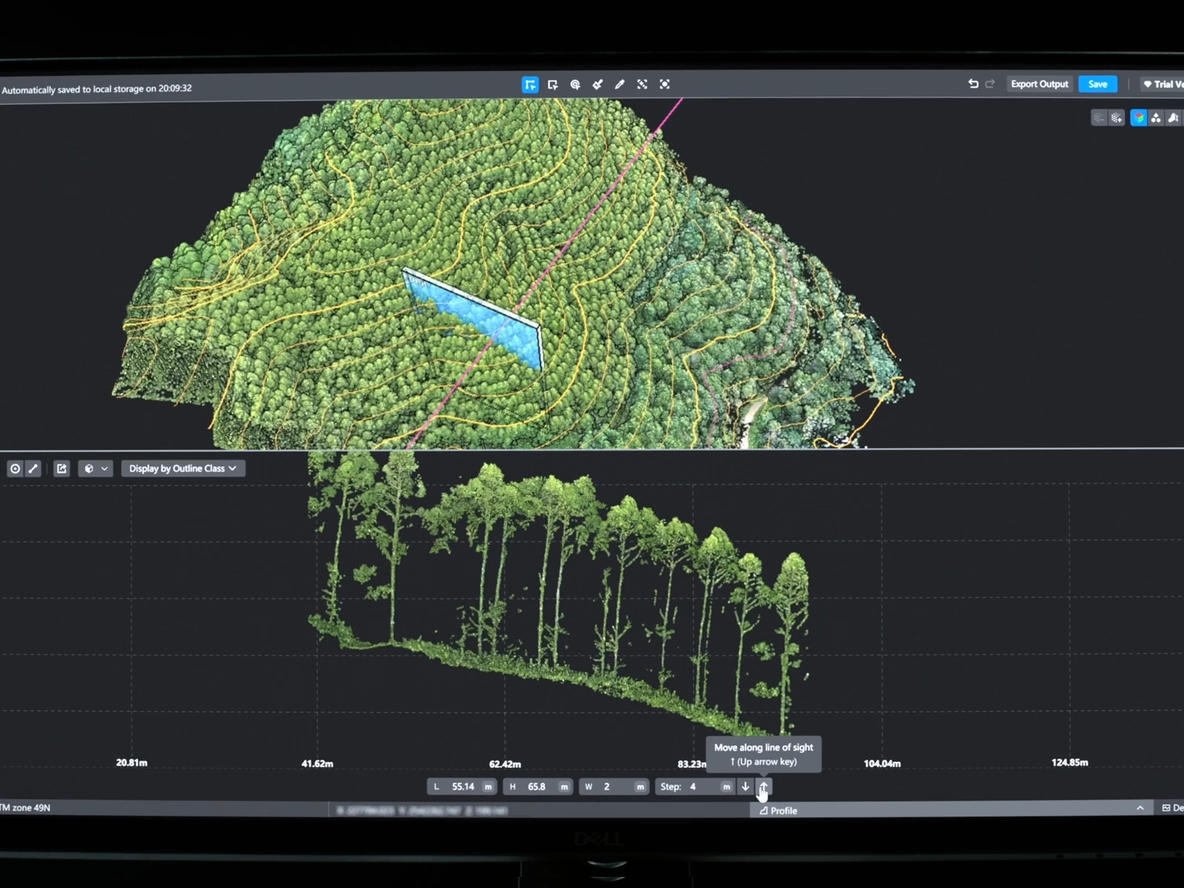
Essential for engineering surveys, planning, and advanced terrain analysis.
Comprehensive Output Capabilities
Together with DJI Modify, Zenmuse L3 produces:
Semantic point cloud
DEM
TIN
Point grid
Contour lines
Multiple visual layers
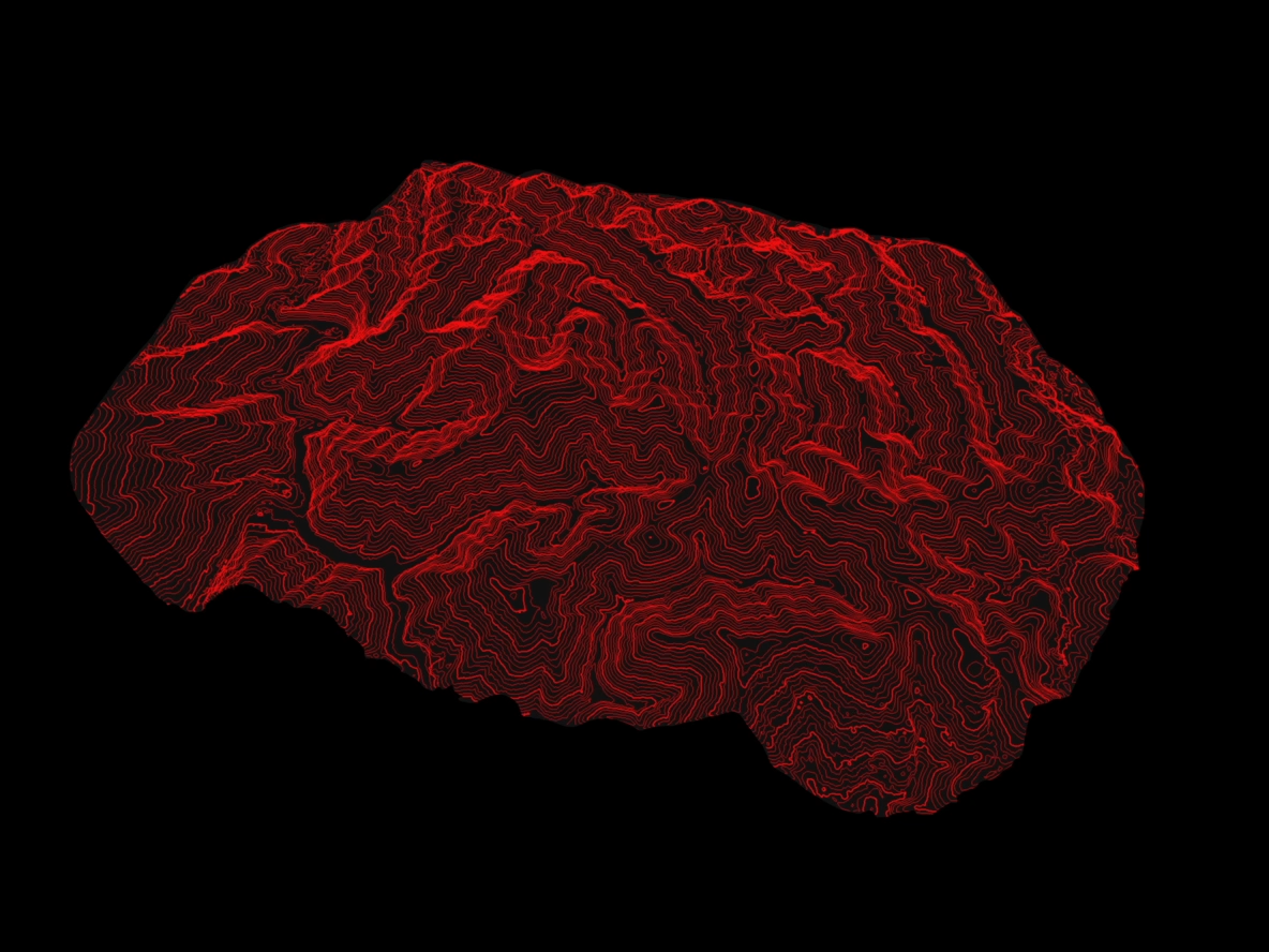
Perfect for CAD, GIS, surveying, construction, and engineering design workflows.
Data Security
Supports CFexpress™ card encryption, preventing unauthorized access
Matrice 400 offers:
One-tap log deletion
AES-256 encrypted video transmission
→ Ensures sensitive data is always protected.